QUESTION PAPER
2022 BOARD EXAM
CBSE Class 12 Humanities Geography Board Paper 2022 — Set 3
2022
Geography
Class 12 Humanities
CBSE EXAMINATION PAPER-2022
GEOGRAPHY
(Solved)
General Instructions :
Read the following instructions carefully and follow them :
- This question paper contains 13 questions. All questions are compulsory.
- This question paper is divided into 3 sections.
- Section A – questions number 1 to 2 are case based questions
- Section B – questions number 3 to 9 are short answer
- Section C – questions number 10 to 13 are long answer
- There is no overall choice given in the question paper. However, an internal choice has been provided in few questions.
- Use of calculator is NOT allowed.
Section A
Read the following source and answer the given questions:
The process of development of tribal area of Bharmaur started in 1970s when Gaddis were included among ‘scheduled tribes’. Under the Fifth Five Year Plan, the tribal sub-plan was introduced in 1974 and Bharmaur was designated as one of the five Integrated Tribal Development Projects (ITDP) in Himachal Pradesh. This area development plan was aimed at improving the quality of life of the Gaddis and narrowing the gap in the level of development between Bharmaur and other areas of Himachal Pradesh. This plan laid the highest priority on the development of transport and communications, agriculture and allied activities, and social and community services.
The most significant contribution of the tribal development sub-plan in Bharmaur region is the development of infrastructure in terms of schools, healthcare facilities, potable water, roads, communications, and electricity. But the villages located along the river Ravi in Holi and Khani areas are the main beneficiaries of infrastructural development. The remote villages in Tundah and Kugti areas still do not have sufficient infrastructure.
(1) Mention the main objective of the ‘integrated tribal development project’ in Bharmaur region.
[1 Mark](2) Explain the outcome of tribal development sub-plan in this region.
[1 Mark](3) Why is it necessary to develop infrastructural facilities for integrated development of a region? Explain.
On the given political outline map of India, locate and label any five from the following Geographical features with appropriate symbols :
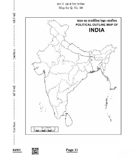
(1) Raniganj — Coal mines
(2) The southern-most station of North-South Corridor.
(3) Khetri— Copper mines
(4) The eastern-most metropolitan city connected by golden quadrilateral.
(5) Jamnagar — Oil refineries.
(6) Balaghat — Manganese mines
Section B
"The quaternary sector along with the tertiary sector has replaced most of the primary and secondary employment." Support the statement.
Why is ‘technological innovation’ essential for industries ? Explain.
“Transport is an organised industry created to satisfy man’s basic need of mobility.” Support the statement.
Mention any four features of non-metallic minerals in India.
Mention any four features of ‘Geothermal energy’ in India.
Section C
Examine any five factors that are responsible for population flow from rural to urban areas in India.
"Pipelines are the most convenient and efficient mode of transporting liquids and gases over long distances in India." Examine the statement.
"Road transport is the most economical for short distances compared to railways in the world." Support the statement.
Paper Details
CBSE Board Exam 2022
Class
Class 12 Humanities
Subject
Geography
Year
2022
Set
Set 3
Other Years — Geography