Class 11 Humanities . Geography . Fundamental Of Physical Geography . World Climate and Climate Change
Chapter 11: World Climate And Climate Change
Ch 11
Geography
Class 11 Humanities
Introduction & Koeppen's Scheme Of Classification Of Climate
Why Classify Climate?
- Purpose: Climate classification organises climate data into smaller units for easier understanding, description and analysis.
- Approaches: The three broad approaches are empirical, genetic and applied.
Koeppen’s Scheme
Development
- 1918Koeppen developed the scheme; it was modified over time and remains widely used.
Major Climatic Groups
- Five groups: Koeppen recognised five major climatic groups; four are based on temperature and one on precipitation.
- Humid and dry: Groups A, C, D and E are humid climates, while Group B represents dry climates.
Subgroups and Letter Codes
| Group | Type | Code | Key characteristic |
|---|---|---|---|
| A — Tropical humid | Tropical wet | Af | No dry season. |
| A — Tropical humid | Tropical monsoon | Am | Monsoonal, with a short dry season. |
| A — Tropical humid | Tropical wet and dry | Aw | Winter dry season. |
| B — Dry | Subtropical steppe | BSh | Low-latitude semi-arid or dry. |
| B — Dry | Subtropical desert | BWh | Low-latitude arid or dry. |
| B — Dry | Mid-latitude steppe | BSk | Mid-latitude semi-arid or dry. |
| B — Dry | Mid-latitude desert | BWk | Mid-latitude arid or dry. |
| C — Warm temperate | Humid subtropical | Cfa | No dry season; warm summer. |
| C — Warm temperate | Mediterranean | Cs | Dry, hot summer. |
| C — Warm temperate | Marine west coast | Cfb | No dry season; warm and cool summer. |
| D — Cold snow-forest | Humid continental | Df | No dry season; severe winter. |
| D — Cold snow-forest | Subarctic | Dw | Winter dry; very severe winter. |
| E — Cold | Tundra | ET | No true summer. |
| E — Cold | Polar ice cap | EF | Perennial ice. |
| H — Highland | Highland | H | Highland climate with snow cover. |
Tropical Wet Climate (Af)
- Rainfall: Significant rainfall occurs every month, often as afternoon thunderstorms.
- Temperature: Temperatures remain uniformly high; daily maximum is around 30 °C and minimum around 20 °C, with a negligible annual range.
- Vegetation and location: Dense-canopied tropical evergreen forests with high biodiversity occur in this climate, including in the East Indies.
What is the basis of Koeppen’s climate classification?
How are seasons of dryness represented in Koeppen’s codes?
Quick recap
- Climate classification organises data into useful units; the main approaches are empirical, genetic and applied.
- Koeppen’s empirical scheme uses temperature and precipitation data and relates them to vegetation.
- The five major groups A–E include four temperature-based groups and one precipitation-based group; A, C, D and E are humid, while B is dry.
- H denotes highland climate; small letters describe precipitation seasonality or temperature severity.
- B climates use S for steppe and W for desert; the codes include low- and mid-latitude types.
- Af has year-round rainfall, uniformly high temperatures and tropical evergreen forest.
Group A : Tropical Humid Climates
Tropical humid climate — A hot, humid climate between the Tropics of Cancer and Capricorn, with high annual rainfall and a very small annual temperature range.
Tropical Humid Climates
- Main controls: The Sun is overhead throughout the year, and the Inter Tropical Convergence Zone (ITCZ) contributes to hot, humid conditions.
- Types: Tropical wet (), tropical monsoon (), and tropical wet and dry ().
| Type | Location | Rainfall and seasonal pattern |
|---|---|---|
| Tropical wet () | Near the Equator; major areas include the Amazon Basin in South America and western equatorial Africa. | The source identifies it as a tropical wet climate but gives no further seasonal details. |
| Tropical monsoon () | Indian subcontinent, northeastern South America and northern Australia. | Heavy rainfall mostly in summer; winter is dry. |
| Tropical wet and dry () | North and south of regions; extensive areas include Brazil and adjoining Bolivia and Paraguay, Sudan, and south of Central Africa. | Less and more variable rainfall than in and ; shorter wet season and longer, more severe dry season. |
Tropical Wet and Dry Climate (): Key Features
- Location pattern: It borders dry climates on western continental margins and or climates on eastern margins.
- Temperature: High throughout the year; the daily temperature range is greatest in the dry season.
- Vegetation: Deciduous forest and tree-scattered grasslands occur in this climate.
Dry Climates (Group B)
Dry climate — A climate with rainfall too low to adequately support plant growth.
- Global distribution: Dry climates occupy broad belts from about to north and south of the Equator.
- Low latitudes (–): Common in subtropical high-pressure zones, where descending air and temperature inversion suppress rainfall.
- Cold-current coasts: On western continental margins, especially western South America, dry conditions may extend farther towards the Equator.
- Middle latitudes (–): Usually found in continental interiors beyond the reach of maritime humid winds, or in regions enclosed by mountains.
- Parent types: Steppe or semi-arid climate () and desert climate ().
| Latitude belt | Steppe / semi-arid | Desert |
|---|---|---|
| – | Subtropical steppe () | Subtropical desert () |
| – | Mid-latitude steppe () | Mid-latitude desert () |
Subtropical Steppe () and Desert ()
| Point | Subtropical steppe () | Subtropical desert () |
|---|---|---|
| Rainfall | Slightly more rainfall than the desert—enough for sparse grasslands. | Very low and highly variable rainfall. |
| Rainfall effects | Rainfall variability can disrupt life and cause famine more often than in deserts. | Short, intense thundershowers often add little soil moisture. |
| Temperature and other features | High summer temperatures and large annual and daily temperature ranges. | High summer temperatures and large annual and daily temperature ranges; fog is common in coastal deserts beside cold currents. |
Recorded Extreme Temperature
- 13 September 1922A shade temperature of was recorded at Al Aziziyah, Libya.
Warm Temperate (Mid-Latitude) Climates (Group C)
Warm temperate climate — A climate group extending mainly along eastern and western continental margins between about and latitude, with generally warm summers and mild winters.
| Type | Seasonal description |
|---|---|
| Humid subtropical () | Dry winter and hot summer |
| Mediterranean () | Dry summer and rainy winter |
| Humid subtropical () | No dry season; mild winter |
| Marine west coast () | Marine-influenced climate with precipitation throughout the year |
Humid Subtropical Climate ()
- Location: Poleward of the Tropics of Cancer and Capricorn; notably the North Indian Plains and interior plains of South China.
- Climate: Similar to , but winters are warm.
Mediterranean Climate ()
- Location: Around the Mediterranean Sea and on western continental coasts between and latitude; examples include central California, central Chile, and southeastern and southwestern Australia.
- Seasonal controls: Subtropical high pressure influences summers; westerly winds influence winters.
- Climate: Hot, dry summers and mild, rainy winters. Average summer temperature is about ; winter is below .
- Precipitation: Annual total is about –.
Humid Subtropical Climate ()
- Location: Eastern continental margins in subtropical latitudes—for example, the eastern United States, southern and eastern China, southern Japan, northeastern Argentina, coastal South Africa, and eastern Australia.
- Rainfall: Unstable air masses bring rain throughout the year; annual precipitation is about –. Summer thunderstorms and winter frontal rain are common.
- Temperature: Mean summer temperature is about ; winter means range from to . The daily temperature range is small.
Marine West Coast Climate ()
- Location: Poleward of Mediterranean climates on western continental margins; examples include northwestern Europe, western North America north of California, southern Chile, southeastern Australia, and New Zealand.
- Marine influence: Moderates temperatures, making winters warmer than at similar latitudes.
- Temperature: Mean summer temperatures are about – and winter temperatures about –; annual and daily temperature ranges are small.
- Precipitation: Occurs throughout the year and varies widely, from about to annually.
- ITCZ
- Inter Tropical Convergence Zone; a major influence on tropical humid conditions.
- Annual temperature range
- The difference between the highest and lowest mean monthly temperatures in a year.
- Diurnal temperature range
- The difference between daytime and nighttime temperatures.
- Frontal precipitation
- Rainfall associated with the meeting of air masses along a front.
How do tropical wet (), monsoon (), and wet-and-dry () climates differ?
Compare Mediterranean () and humid subtropical () climates.
Quick recap
- Tropical humid climates are hot and rainy, with a small annual temperature range; their types are , and .
- has heavy summer rain and dry winters, while has a longer and more severe dry season.
- Dry climates receive too little rain for adequate plant growth and are classified as steppe/semi-arid () or desert ().
- Dry-climate subtypes are subtropical at – and mid-latitude at –.
- Warm temperate climates include , , and , with different rainfall seasonality and locations.
- Marine influence moderates temperatures; Mediterranean climates have dry summers and rainy winters.
Cold Snow Forest Climates And Climate Change
Cold Snow Forest Climates (D)
How the Dw seasonal wind reversal develops
- Winter: A pronounced high-pressure anticyclone develops over the region.
- Summer: The anticyclone weakens, producing a monsoon-like reversal of winds.
- Temperature: Poleward summers are cooler, while winters can remain below freezing for up to seven months.
Polar Climates (E)
Permafrost — Ground whose subsoil remains permanently frozen.
Ice sheets and icebergs
- Process: Snow and ice accumulate → pressure deforms the ice sheets → broken ice moves as icebergs.
- Movement: Icebergs float in Arctic and Antarctic waters.
Highland Climates (H)
- Control: Highland climates are governed by topography, with substantial climatic changes over short distances.
- Variation: Temperature, precipitation types and precipitation intensity vary across highlands.
- Zonation: Climatic types are arranged in vertical zones according to elevation.
Climate Change
| Evidence | What it indicates |
|---|---|
| Geological records | Alternation of glacial and interglacial periods. |
| Landforms at high altitudes and latitudes | Past advances and retreats of glaciers. |
| Sediments in glacial lakes | The occurrence of warmer and colder periods. |
| Tree rings | Past wet and dry periods. |
| Historical records | Climate variability and its effects, including crop yields, crop failures, floods and migration. |
Climate changes through geological and Indian history
- About 500–300 million years agoEarth was warm during the Cambrian, Ordovician and Silurian periods.
- Pleistocene epochGlacial and interglacial periods occurred; the last major glacial peak was about 18,000 years ago.
- About 10,000 years agoThe present interglacial period began.
- Around 8,000 B.C.Archaeological findings indicate that the Rajasthan desert had a wet and cool climate.
- 3,000–1,700 B.C.Rajasthan received higher rainfall.
- About 2,000–1,700 B.C.The region was the centre of the Harappan civilisation.
- After about 1,700 B.C.Dry conditions in the region became more pronounced.
Climate variability in the recent past
- 10th–11th centuriesWarm, dry conditions occurred in Europe when the Vikings settled in Greenland.
- 1550–about 1850Europe experienced the Little Ice Age.
- 1885–1940World temperatures showed an upward trend.
- After 1940The rate of temperature increase slowed.
- 1930sSevere drought in the southwestern Great Plains of the United States became known as the Dust Bowl.
- 1967–1977The Sahel region south of the Sahara experienced a devastating drought.
- 1990sThe decade recorded the century's warmest temperatures and some of the world's worst floods.
Causes of Climate Change
| Cause | How it may affect climate | Important note |
|---|---|---|
| Sunspot activity | Sunspots are dark, cooler patches on the Sun that vary cyclically. Some meteorologists associate more sunspots with cooler, wetter, stormier weather, and fewer with warmer, drier conditions. | These findings are not statistically significant. |
| Milankovitch oscillations | Cycles in Earth's orbit, wobble and axial tilt change the amount of solar energy received, potentially affecting climate. | These are changes in Earth's orbital characteristics and orientation. |
| Volcanism | Eruptions release aerosols that remain in the atmosphere and reduce solar radiation reaching Earth's surface. | After the Pinatubo and El Chichón eruptions, average global temperature fell to some extent for several years. |
Volcanic aerosols and temperature
- Volcanic eruption releases aerosols into the atmosphere.
- Aerosols remain in the atmosphere for a considerable time.
- Less solar radiation reaches Earth's surface.
- Average temperature can fall for some years.
- Interglacial period
- A warmer interval between glacial periods.
- Sunspots
- Dark, cooler patches on the Sun that increase and decrease cyclically.
- Milankovitch oscillations
- Cycles in Earth's orbit, wobble and axial tilt that alter incoming solar energy.
- Anthropogenic
- Caused by human activity.
How do tundra and ice cap climates differ?
What evidence shows that climate has changed in the past?
How can volcanic eruptions influence climate?
Quick recap
- D climates occur mainly between and N; Df has humid winters and lies poleward of marine west coast climate and mid-latitude steppe, while Dw has dry winters.
- Polar climates beyond latitude are tundra (ET) or ice cap (EF).
- Highland climates vary with topography and elevation, creating vertical climatic zones.
- Geological, environmental and historical evidence shows that climate has varied naturally through time.
- Sunspots, Milankovitch oscillations and volcanic aerosols are possible natural influences on climate.
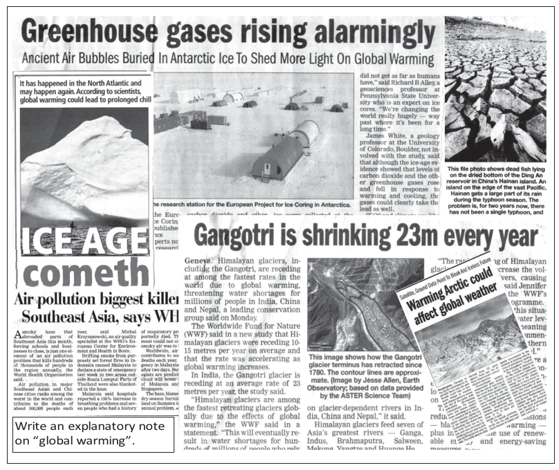
- Rising greenhouse-gas concentrations due to human activity are likely to cause global warming.
Global Warming
The Greenhouse Effect
- Process: The atmosphere transmits incoming solar radiation but absorbs most of the long-wave radiation emitted upward by Earth’s surface.
- Warming: This absorption warms the atmosphere; the processes involved are collectively called the greenhouse effect.
Greenhouse Gases and Their Effects
| Gas | Source or role | Key point |
|---|---|---|
| Carbon dioxide () | Mainly released by burning fossil fuels—oil, gas and coal. | It has the largest atmospheric concentration among the GHGs discussed. Forests and oceans are sinks; forests use it in growth. |
| CFCs | Produced by human activity. | Highly effective GHGs; in the stratosphere they also destroy ozone. |
| Methane () and nitrous oxide () | Identified as major GHGs of concern. | Their warming effectiveness depends on concentration increase, lifetime and absorbed radiation wavelength. |
| Ozone () | Forms in the stratosphere when ultraviolet rays convert oxygen into ozone. | Stratospheric ozone absorbs ultraviolet rays; ozone in the lower troposphere is effective at absorbing terrestrial radiation. |
Carbon Dioxide and Ozone
Sources and Sinks of Carbon Dioxide
- Fossil-fuel combustion and deforestation add to the atmosphere.
- Forests and oceans absorb carbon dioxide and act as sinks.
- Changes in the balance between sources and sinks alter atmospheric concentration.
International Action and Possible Impacts
Key Dates and Temperature Records
- 1997The Kyoto Protocol was proclaimed.
- 2005The Kyoto Protocol entered into force.
- By 2012The protocol’s 35 industrialised countries were bound to cut emissions to 5% below 1990 levels.
- 1901–1944Global temperature rose by about 0.4°C.
- 1944–1977A slight cooling occurred, more marked in the Northern Hemisphere.
- 1977–1999Global temperature rose by about 0.4°C.
- End of the 20th centuryGlobal mean temperature was about 0.6°C above the level recorded at the end of the 19th century.
- 1856–2000Seven of the warmest years in this record occurred in the final decade; 1998 was the warmest year, possibly of the whole millennium.
Observed Global Warming
What determines the effectiveness of a greenhouse gas?
How can global warming cause sea-level rise?
Quick recap
- Greenhouse gases absorb outgoing long-wave radiation and warm the atmosphere.
- Major GHGs include carbon dioxide, CFCs, methane, nitrous oxide and ozone.
- Fossil fuels and deforestation raise atmospheric carbon dioxide; forests and oceans act as sinks.
- CFCs deplete stratospheric ozone, producing severe depletion known as the ozone hole over Antarctica.
- The Kyoto Protocol set a 2012 emissions target for 35 industrialised countries relative to 1990.
- Observed warming includes two major 20th-century rises of about 0.4°C each and a 0.6°C end-century increase over the late-19th-century level.
- Global warming can raise sea levels, threaten coasts and islands, and harm life-support systems.
Geography — ALL CHAPTERS
1
GEOGRAPHY AS A DISCIPLINE
2
THE ORIGIN AND EVOLUTION OF THE EARTH
3
INTERIOR OF THE EARTH
4
DISTRIBUTION OF OCEANS AND CONTINENTS
5
Geomorphic Processes
6
Landforms And Their Evolution
7
Composition And Structure Of Atmosphere
8
Solar Radiation, Heat Balance And Temperature
9
Atmospheric Circulation And Weather Systems
10
Water In The Atmosphere
11
World Climate And Climate Change
12
Water ( Oceans )
13
Movements Of Ocean Water
14
Biodiversity And Conservation
1
India - Location
2
Structure And Physiography
3
Drainage System
4
Climate
5
Natural Vegetation
6
Natural Hazards And Disasters