Class 7 . Social Science . Exploring Society India and Beyond Part I . Geographical Diversity of India
Chapter 1: Geographical Diversity of India
Ch 1
Social Science
Class 7
Introduction
Indian subcontinent — A large region of Asia that includes India and its neighbouring countries.
India and the Indian Subcontinent
- Location: India is part of Asia and is the world’s seventh-largest country.
- Neighbouring countries: Pakistan, Bangladesh, Nepal, Bhutan, Sri Lanka and Myanmar are included with India in the Indian subcontinent.
- Map reading: A physical map shows landforms and uses colours in its legend to represent different altitudes.
India’s Five Major Regions
| Region | Main feature |
|---|---|
| Great mountain zone | Mountain region in the north |
| Plains of the Ganga and the Indus | Great river plains |
| Desert region | Includes the Thar Desert |
| Southern peninsula | Peninsular region of southern India |
| Islands | Island regions, including those in the Indian Ocean |
Natural Boundaries and Their Influence
| Direction | Geographical feature |
|---|---|
| North | Himalayan Mountain range |
| West | Thar Desert and Arabian Sea |
| South | Indian Ocean |
| East | Bay of Bengal |
How Geography Shapes India
- Mountain ranges, deserts and surrounding seas form natural boundaries.
- These features separate India from the rest of the Asian continent.
- They have played an important role in shaping India’s climate, culture and history.
Using a Physical Map
- Landforms: Physical maps help identify mountains, plains and plateaus.
- Altitude: Map colours indicate the height of different areas; use the legend to interpret them.
- Location: Latitude and longitude lines help locate places approximately on a map.
- Subcontinent
- A large, distinct part of a continent; India and its neighbouring countries form the Indian subcontinent.
- Altitude
- The height of a place above sea level.
- Physical map
- A map showing natural features such as mountains, plains and plateaus.
Quick recap
- India is the world’s seventh-largest country and lies in Asia.
- India and six neighbouring countries together form the Indian subcontinent.
- India is commonly described through five broad geographical regions.
- The Himalayas, Thar Desert, Arabian Sea, Indian Ocean and Bay of Bengal form natural boundaries.
- These geographical features have influenced India’s climate, culture and history.
- On physical maps, colours represent altitude; consult the legend to read them.
The Himalayas Part-1
The Himalayan Range
Extent and height
- Extent: The Himalayas form a vast mountain range across India, Nepal, Bhutan, China, Pakistan and Afghanistan.
- High peaks: Many Himalayan peaks rise above 8,000 metres; these peaks are called the Eight Thousanders.
- Highest peak: Mount Everest is the highest mountain in the world.
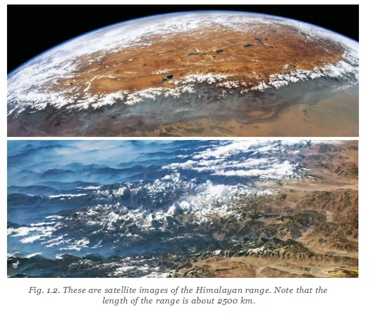
The Himalayas as Asia’s Water Tower
From Himalayan snow to people’s needs
- Summer warmth melts mountain snow.
- Meltwater feeds major rivers, including the Ganga, Indus and Brahmaputra, and their tributaries.
- These waters support drinking, farming and industrial needs for hundreds of millions of people.
Water Tower of Asia — A name for the Himalayas because their snow and glaciers feed rivers that supply water to large populations.
Gaumukh and the Bhagirathi
A Himalayan river source
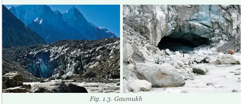
- Bhagirathi: A major tributary of the Ganga; it originates at Gaumukh in Uttarakhand.
- Gaumukh: Meaning “Cow’s Mouth”, it is the edge of the Gangotri Glacier.
- Gangotri Glacier: One of the largest glaciers in the Indian Himalayas; it is considered sacred.
- Importance: Gaumukh is a pilgrimage site and a popular trekking destination.
Cultural and Spiritual Significance
- Sacred mountains: The Himalayas are important to many cultures and belief systems.
- Places of worship: Temples and monasteries in the mountains attract people for prayer and meditation.
- Eight Thousanders
- Himalayan peaks with heights above 8,000 metres.
- Tributary
- A river or stream that flows into a larger river.
- Glacier
- A large mass of ice that persists over time and can feed rivers as it melts.
- Gaumukh
- The source area of the Bhagirathi at the edge of the Gangotri Glacier in Uttarakhand.
Quick recap
- The Himalayas extend across six Asian countries and contain many peaks above 8,000 metres.
- Mount Everest is the world’s highest mountain.
- Melting Himalayan snow feeds the Ganga, Indus and Brahmaputra river systems.
- Himalayan rivers provide water for drinking, farming and industry.
- The Bhagirathi begins at Gaumukh, at the edge of the Gangotri Glacier in Uttarakhand.
- The Himalayas are culturally and spiritually important, with sacred sites, temples and monasteries.
The Himalayas Part-2
Formation of the Himalayas
- Gondwana: India was once part of this larger landmass, whose neighbours included Africa.
- Collision: India moved north and collided with Eurasia about 50 million years ago.
- Mountain building: The land between the two landmasses crumpled and rose, forming the Himalayas.
- Ongoing movement: India still pushes into Asia at about ; the Himalayas rise about , or roughly over a millennium.
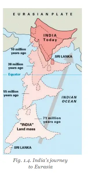
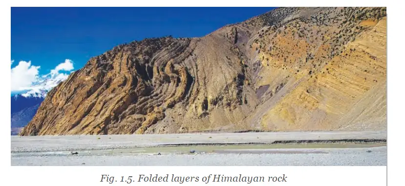
The Himalayas Through Time
- Long agoIndia was part of Gondwana and later began moving north.
- About 50 million years agoIndia collided with Eurasia; compression and uplift helped form the Himalayas.
- TodayIndia continues to push into Asia, and the Himalayas are still rising slowly.
Meaning of the Name and Main Ranges
Himalaya — A Sanskrit name formed from *hima* (snow) and *ālaya* (abode or dwelling), meaning “abode of snow.”
| Range | Position and features | Climate, wildlife and settlement | Examples / significance |
|---|---|---|---|
| Himadri (Greater Himalayas) | Highest and most rugged range | Snow-covered throughout the year; few human settlements | Includes Mount Everest and Kanchenjunga |
| Himachal (Lower Himalayas) | Lies south of the Himadri | Moderate climate supports rich biodiversity and human habitation | Hill stations: Nainital and Mussoorie (Uttarakhand); Darjeeling (West Bengal); Shimla (Himachal Pradesh) |
| Shivalik Hills (Outer Himalayas) | Outermost and lowest range; rolling hills and dense forests | Foothills rich in wildlife | Transition zone between the Himalayas and the Gangetic (Northern) Plains |
Himalayan Houses and Conservation
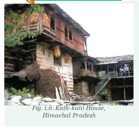
- Kath-kuni / dhajjidewari: Traditional western Himalayan house styles built with locally available stone and wood.
- Benefits: The construction helps keep houses warm and resist damage from mild earthquakes.
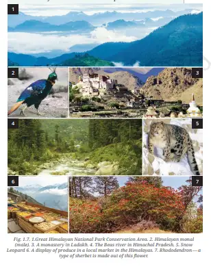
- Great Himalayan National Park: Located in Himachal Pradesh; it has diverse flora and fauna and is a UNESCO World Heritage Site.
- Conservation: The government and village communities living inside the park help preserve its biodiversity.
- Gondwana
- The larger landmass that included India before it moved north.
- Himadri
- The highest and most rugged Himalayan range, also called the Greater Himalayas.
- Kath-kuni
- A western Himalayan house style built using local stone and wood.
- Biodiversity
- The variety of plant and animal life in a region.
How were the Himalayas formed?
Name the three main Himalayan ranges and state one feature of each.
Quick recap
- India was once part of Gondwana and collided with Eurasia about 50 million years ago.
- The Himalayas formed as land between India and Eurasia crumpled and rose.
- India’s continuing movement means the Himalayas are still rising slowly.
- The three main ranges are Himadri, Himachal and Shivalik, each with distinct features.
- Himachal hill stations include Nainital and Mussoorie in Uttarakhand, Darjeeling in West Bengal and Shimla in Himachal Pradesh.
- Kath-kuni and dhajjidewari houses use local stone and wood; government and village communities help conserve the Great Himalayan National Park.
The Cold Desert of India
Ladakh: The Cold Desert
Cold desert — A desert region with very little rainfall and cold conditions; Ladakh is India’s cold desert.
Ladakh’s landscape, wildlife and culture
- Climate and terrain: Winter temperatures can fall below . The rugged landscape has rocky terrain, deep valleys and lakes.
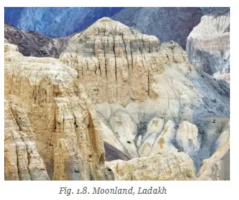
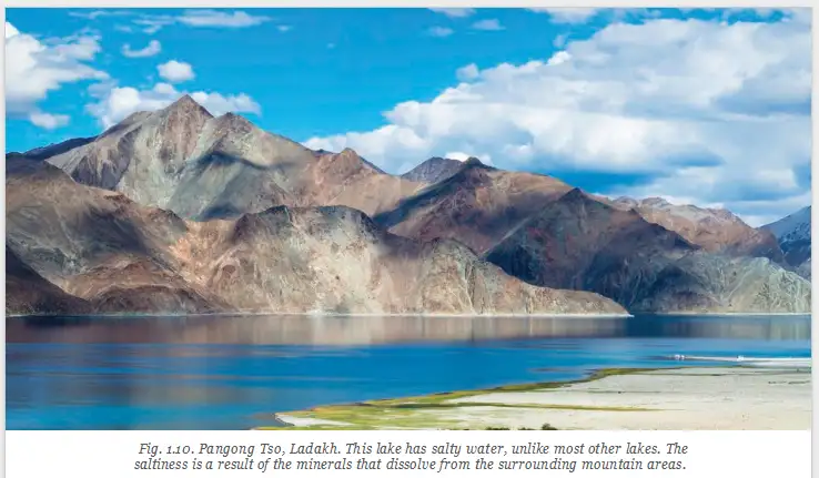
- Moonland: Ladakh’s terrain resembles the Moon, so it is also called “moonland.” Pangong Tso means Pangong Lake and is a saline lake.
- Formation: The Indian landmass collided with Eurasia, folding the mountains. This folded region was once part of an ocean, so its rocks are largely made of sand and clay.
- Erosion: Wind and rain have eroded the mountains, shaping the rocky landscape.
- Wildlife and people: Snow leopards, ibex and Tibetan antelopes live here. The Ladakhi people lead a simple life.
- Culture: Ladakh is known for ancient monasteries and colourful festivals such as Losar and the Hemis Festival.
The Gangetic Plains
Fertile land and rivers
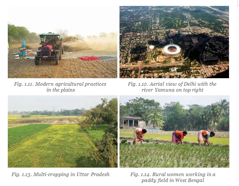
- Location and importance: South of the Himalayas lie the vast, flat and fertile Gangetic Plains, an important region in India’s history and civilisation.
- River systems: The Ganga, Indus and Brahmaputra, with their tributaries, bring water and minerals that enrich the soil.
- Agriculture and population: Fertile soil supports abundant agriculture, including multi-cropping; a large proportion of India’s population lives in these plains.
- Other uses: Rivers are also a source of electricity generation.
- Brahmaputra: Its name means “the son of Brahma.” Unlike rivers that may dry up in summer, the Brahmaputra gets bigger during that season.
Transport and trade
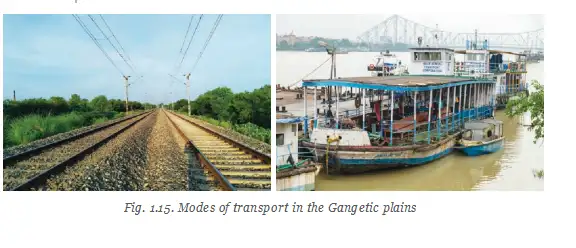
- Flat terrain: The plains make it easier to develop extensive road and railway networks.
- Movement: Roads and railways move people and goods over long distances; rivers have supported travel and trade for millennia.
Quick recap
- Ladakh is a cold desert with very little rainfall and winter temperatures below .
- Ladakh’s rocky “moonland” terrain formed through mountain folding and erosion by wind and rain.
- Ladakh is home to snow leopards, ibex and Tibetan antelopes, and is known for monasteries and festivals such as Losar and Hemis.
- The Ganga, Indus and Brahmaputra river systems enrich the Gangetic Plains and support agriculture and a large population.
- Flat land and rivers support transport, travel and trade; rivers also help generate electricity.
- The Brahmaputra means “the son of Brahma” and gets bigger during summer.
The Great Indian Desert or Thar Desert
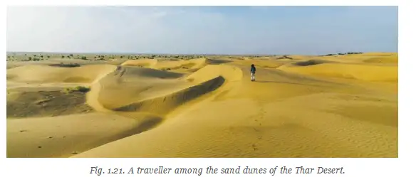
Sand Dunes
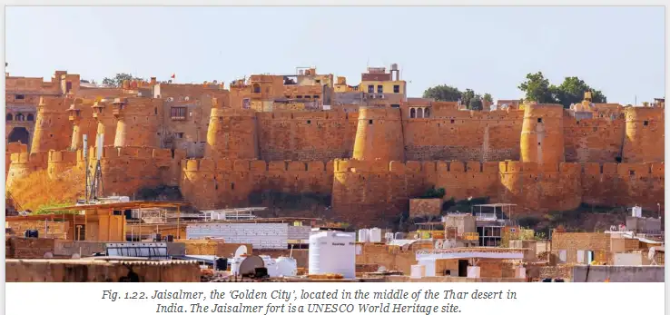
Jaisalmer
- Jaisalmer: Known as the “Golden City,” it has a historic fort in the Thar Desert.
Location and Characteristics
- Location: Most of the Thar Desert lies in India, across Rajasthan, Gujarat, Punjab, and Haryana.
- Characteristics: The Thar is a vast arid region with golden sand dunes, rugged terrain, very hot days, cold nights, and scarce water.
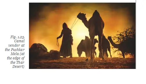
People and Life in the Desert
Water Scarcity and Conservation
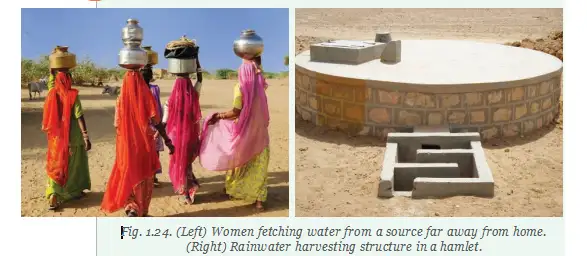
- Arid
- Very dry, with little water available.
- Sand dune
- A hill-like mass of sand shaped by wind.
- Taanka or kund
- A traditional system for collecting and storing rainwater.
Quick recap
- The Thar is a vast arid region, most of which lies in India.
- It spans Rajasthan, Gujarat, Punjab and Haryana.
- Wind shapes sand into dunes, some as high as 150 metres.
- Very hot days, cold nights and scarce water make the Thar a natural barrier.
- People adapt their food, clothing and lifestyles to desert conditions.
- Women may travel long distances daily to collect water; used rinse water can be reused.
- Taankas or kunds collect and store rainwater, often for drinking.
The Aravalli Hills
The Aravalli Hills
Age, height and extent
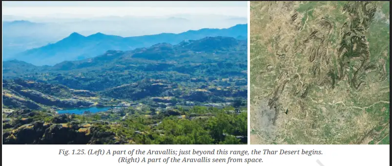
- Age: The Aravallis are among the world’s oldest mountain ranges, about 2.5 billion years old, with many peaks and ridges.
- Height: Mount Abu is the highest peak, rising above 1,700 m; most hills are between 300 and 900 m high.
- Extent: The range spans Delhi, Rajasthan, Haryana and Gujarat.
- Landscape: The terrain changes markedly between Mount Abu and the Thar Desert near Jodhpur.
Importance of the Aravallis
- Climate and desert barrier: The range helps shape northwestern India’s geography and climate and prevents the Thar Desert from expanding farther east.
- Minerals: The Aravallis contain marble, granite, zinc and copper, supporting mining and construction.
- Zawar mines: Evidence shows that more than eight centuries ago, Indians had mastered zinc extraction—a skill described as the first of its kind in the world.
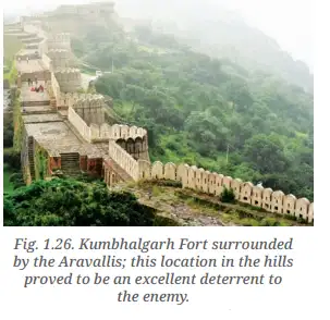
- Historic forts: Chittorgarh, Kumbhalgarh and Ranthambore are located in the Aravallis.
The Peninsular Plateau
Plateau — A raised landform with a more or less flat surface; some sides often have steep slopes.
Location and physical features
- Location: The Peninsular Plateau is an ancient, triangular region in central and southern India.
- Name: It is called a peninsular plateau because the peninsula is surrounded by the Arabian Sea, Bay of Bengal and Indian Ocean on three sides.
- Borders: The Western Ghats and Eastern Ghats border the plateau.
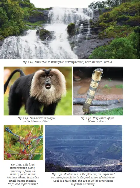
- Ghats: The Western Ghats are taller and form a wall along the western coast; their steep sides have waterfalls during the monsoon.
Rivers and resources
- Resources: The plateau is rich in minerals, forests and fertile land, making it important to India’s economy.
- Slope and flow: The plateau tilts slightly east, so several rivers flow towards the Bay of Bengal.
- Uses: Rivers provide water for farming and industries, and support hydroelectric power generation.
| Direction | Rivers | Origin and destination |
|---|---|---|
| East-flowing | Godavari, Krishna, Mahanadi | Originate on the plateau and drain into the Bay of Bengal |
| West-flowing | Narmada, Tapti | Drain into the Arabian Sea |
Forests, tribal communities and waterfalls
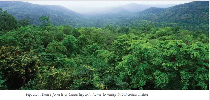
- Tribal communities: Dense plateau forests are home to the Santhal, Gond, Baiga, Bhil and Korku communities, whose languages, traditions and ways of life are closely connected to Nature.
- Wider distribution: Tribal communities are spread across Jharkhand, West Bengal, Odisha, Assam, Madhya Pradesh, Chhattisgarh, Maharashtra, Telangana and Gujarat.
- Waterfalls: Rivers flowing over uneven, rocky plateau surfaces create waterfalls that attract tourists and help generate hydroelectric power and supply irrigation water.
Quick recap
- The Aravallis are about 2.5 billion years old; Mount Abu is their highest peak, above 1,700 m.
- The Aravalli Range spans Delhi, Rajasthan, Haryana and Gujarat and limits the Thar Desert’s eastward expansion.
- Aravalli minerals include marble, granite, zinc and copper; Zawar is known for ancient zinc extraction.
- The Peninsular Plateau is an ancient triangular region in central and southern India, bordered by the Western and Eastern Ghats.
- Godavari, Krishna and Mahanadi originate on the plateau and flow east; Narmada and Tapti flow west.
- Plateau forests support tribal communities, while rivers and waterfalls help provide irrigation and hydroelectric power.
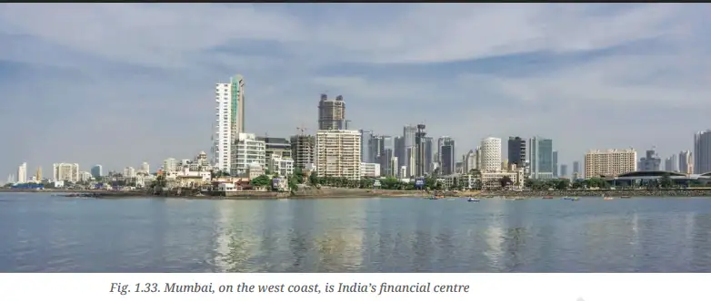
- Mumbai is on India’s west coast and is a financial centre.
India’s Amazing Coastline
India’s Coastline
- Length: India’s coastline is over 7,500 km long.
- Variety: It includes sandy beaches, rocky shores, forests, islands and coral reefs.
The West Coast
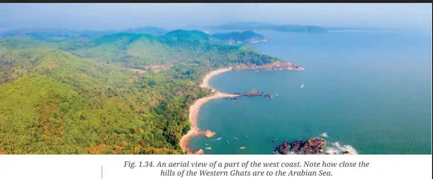
- Extent: It stretches from Gujarat to Kerala, passing through Maharashtra, Goa and Karnataka.
- Rivers: Many rivers rise in the Western Ghats, flow swiftly and commonly form estuaries.
- Coastal features: Short rivers bring alluvial deposits; the coast has coves, creeks and estuaries. The Narmada and Tapti have the largest estuaries.
- Importance: West-coast ports and cities have been centres of economic activity for millennia.
The East Coast
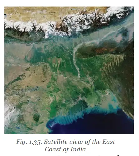
- Location and extent: It lies between the Eastern Ghats and the Bay of Bengal, from the Ganga delta to Kanyakumari.
- Landforms: The East Coast has wide plains and major deltas formed by the Mahanadi, Godavari, Krishna and Kaveri.
- Water bodies: Chilika Lake and Pulicat Lake are important coastal water bodies; Pulicat is a lagoon.
- Fertile land: Delta sediments create fertile areas well suited to farming.
Delta — A landform formed when a river deposits sediments at its mouth into a larger body of water, such as an ocean, lake or another river; the deposits build into a triangular or fan-shaped area.
| Point | West Coast | East Coast |
|---|---|---|
| Setting | Along the Arabian Sea, with the Western Ghats close by | Between the Eastern Ghats and the Bay of Bengal |
| Rivers and landforms | Short, swift rivers commonly form estuaries | Major rivers create wide plains and deltas |
| Examples | Narmada and Tapti estuaries | Mahanadi, Godavari, Krishna and Kaveri deltas |
Indian Islands
- Location: India’s island groups lie in the Indian Ocean, the Arabian Sea and the Bay of Bengal.
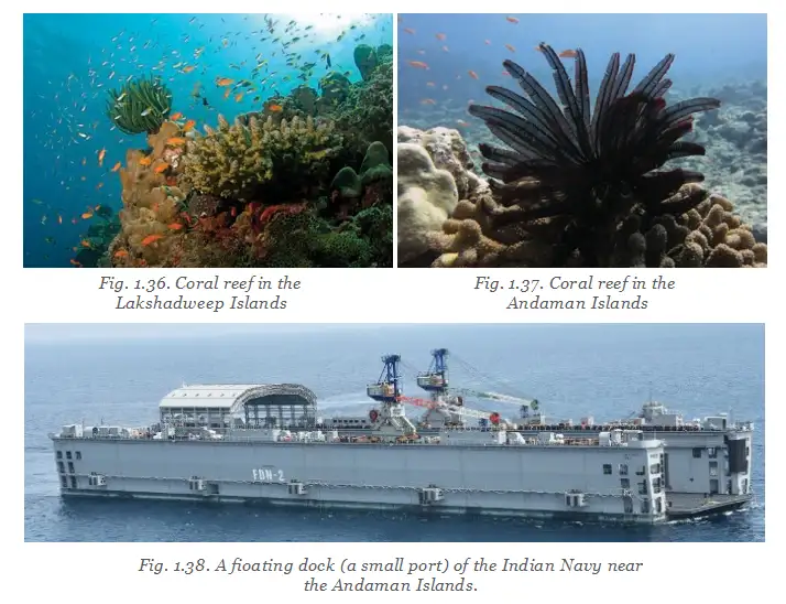
- Main groups: Lakshadweep is in the Arabian Sea; the Andaman and Nicobar Islands are in the Bay of Bengal.
- Natural features: The islands have varied wildlife, beaches, coral reefs and volcanoes.
- Early inhabitants: Ancient tribes made these islands their home tens of thousands of years ago.
Lakshadweep Islands
- Location: This archipelago lies in the Arabian Sea, near Kerala’s Malabar Coast.
- Composition and number: It consists of 36 coral islands; not all are inhabited.
- Significance: India’s marine area around the islands supports fishing, resource exploration and environmental protection.
Andaman and Nicobar Islands
- Composition: This archipelago has more than 500 large and small volcanic islands, divided into the Andaman and Nicobar groups.
- Strategic position: The islands act as outposts, giving India an important presence in the ocean.
- Nature: They support a variety of plant and animal life.
- History: Cellular Jail in the Andaman Islands imprisoned many freedom fighters under harsh conditions. It is preserved to remember their sacrifices.
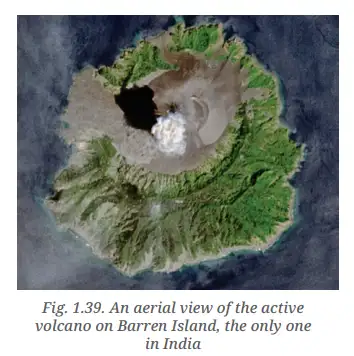
Barren Island
- Volcano: Barren Island in the Andaman and Nicobar Islands has India’s only active volcano.
- Eruptions: It sometimes erupts, sending smoke and lava into the sky.
- Lagoon
- A body of water separated from a larger water body by a natural barrier.
- Archipelago
- A group of islands.
- Coral island
- An island made of coral.
- Estuary
- The mouth of a river where it meets a larger body of water.
How do the West and East coasts differ?
Name India’s two major island groups and state where they are located.
Quick recap
- India’s coastline is over 7,500 km long.
- The West Coast has swift rivers, estuaries, coves and creeks.
- The East Coast has broad plains, fertile deltas and coastal lagoons.
- Lakshadweep has 36 coral islands in the Arabian Sea.
- The Andaman and Nicobar Islands include more than 500 volcanic islands in the Bay of Bengal.
- Barren Island is India’s only active volcano.
The Delta in West Bengal and the Sundarbans
The Sundarbans Delta
Location and features
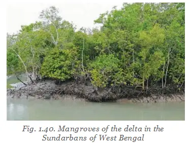
- Location: The Sundarbans lie in the delta formed by the Ganga, Brahmaputra and their tributaries.
- Cross-border region: About half of the delta is in India and the rest is in Bangladesh.
- Landscape: River, sea and land environments meet here.
- Recognition: The Sundarbans is a UNESCO World Heritage site.
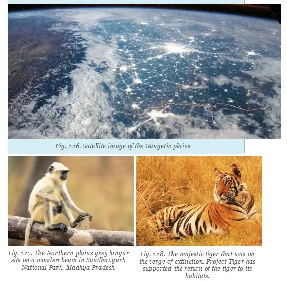
- Wildlife: It supports many species, including the Royal Bengal Tiger.
The Hills of the Northeast
Meghalaya Plateau
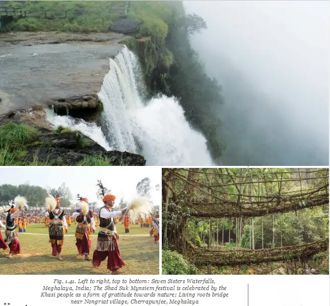
- Hills: The Garo, Khasi and Jaintia hills are part of the Meghalaya Plateau.
- Climate and scenery: The region is known for lush greenery, rainfall among the highest in the world and waterfalls.
- Environment: High rainfall helps support rich forests, distinctive wildlife and fertile land.
Mawlynnong and Living Root Bridges
Mawlynnong Village
- Location: Mawlynnong is in the East Khasi Hills of Meghalaya.
- Reputation: It is renowned as the “cleanest village in Asia.”
- Eco-friendly practices: The village is known for cleanliness, bamboo dustbins and environmentally friendly living.
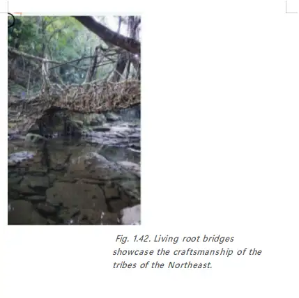
- Living root bridges: These are made by guiding and weaving tree roots over many years.
- Delta
- A low-lying area formed where a river deposits material near its mouth.
- Sundarbans
- A cross-border delta region shared by India and Bangladesh, known for its mangrove forests and wildlife.
- Meghalaya Plateau
- A plateau region that includes the Garo, Khasi and Jaintia hills.
- Living root bridge
- A bridge formed by guiding and weaving tree roots over many years.
Name the rivers that form the Sundarbans delta.
What features make Mawlynnong well known?
Quick recap
- The Sundarbans delta is formed by the Ganga, Brahmaputra and their tributaries.
- About half of the Sundarbans is in India and the rest is in Bangladesh.
- The Sundarbans is a UNESCO World Heritage site and home to the Royal Bengal Tiger.
- The Garo, Khasi and Jaintia hills are part of the Meghalaya Plateau.
- The region experiences rainfall among the highest in the world; it supports forests, wildlife, waterfalls and fertile land.
- Mawlynnong is known for cleanliness and living root bridges made from tree roots over many years.
Before We Move On
India and Its Geographical Diversity
Key Features
- India gives its name to the subcontinent of which it is a part.
- Landforms and climate range from the snowy Himalayas to the hot Thar Desert.
- Plains are watered by many rivers; the peninsular plateau lies between the Arabian Sea to the west and the Bay of Bengal to the east.
How Geography Shapes Life
- Different geographical features
- Varied conditions in soil, plants, animals and ways of life
- Different economic opportunities and a rich culture
- Geography helps shape civilisation
- Flora
- The plant life of a region.
- Fauna
- The animal life of a region.
- Peninsular plateau
- The plateau region of India, with the Arabian Sea to its west and the Bay of Bengal to its east.
Quick recap
- India gives its name to the subcontinent it belongs to.
- India’s geography ranges from the Himalayas to the Thar Desert.
- Many rivers water the plains; the peninsular plateau lies between two seas.
- Geography affects soil, plants, animals, livelihoods, economic opportunities and culture.
- Geographical features have played an important role in shaping civilisation.
Social Science — ALL CHAPTERS
1
Geographical Diversity of India
2
Understanding the Weather
3
Climates of India
4
New Beginnings Cities and States
5
The Rise of Empires
6
The Age of Reorganisation
7
The Gupta Era: An Age of Tireless Creativity
8
How the Land Becomes Sacred
9
From the Rulers to the Ruled: Types of Governments
10
The Constitution of India - An Introduction
11
From Barter to Money
12
Understanding Markets
1
The Story of Indian Farming
2
India and Her Neighbours
3
Empires and Kingdoms: 6th to 10th Centuries
4
Turning Tides: 11th and 12th Centuries
5
India, a Home to Many
6
The State, the Government, and You
7
Infrastructure: Engine of India’s Development
8
Banks and the Magic of Finance