Class 7 . Social Science . Exploring Society India and Beyond Part II . Infrastructure Engine of India S Development
Chapter 7: Infrastructure: Engine of India’s Development
Ch 7
Social Science
Class 7
Introduction
Infrastructure and the Development Goal
- Development: Infrastructure connects communities and supports economic activity and national prosperity.
- Quality of life: Reliable infrastructure makes daily life easier and helps people access jobs, markets and services.
- Goal: A developed India should provide urban and rural areas with comparable roads, power, water and communication.
Meaning and Types of Physical Infrastructure
Physical infrastructure — The network of tangible structures and systems built to keep cities and villages functioning.
| Type | Examples |
|---|---|
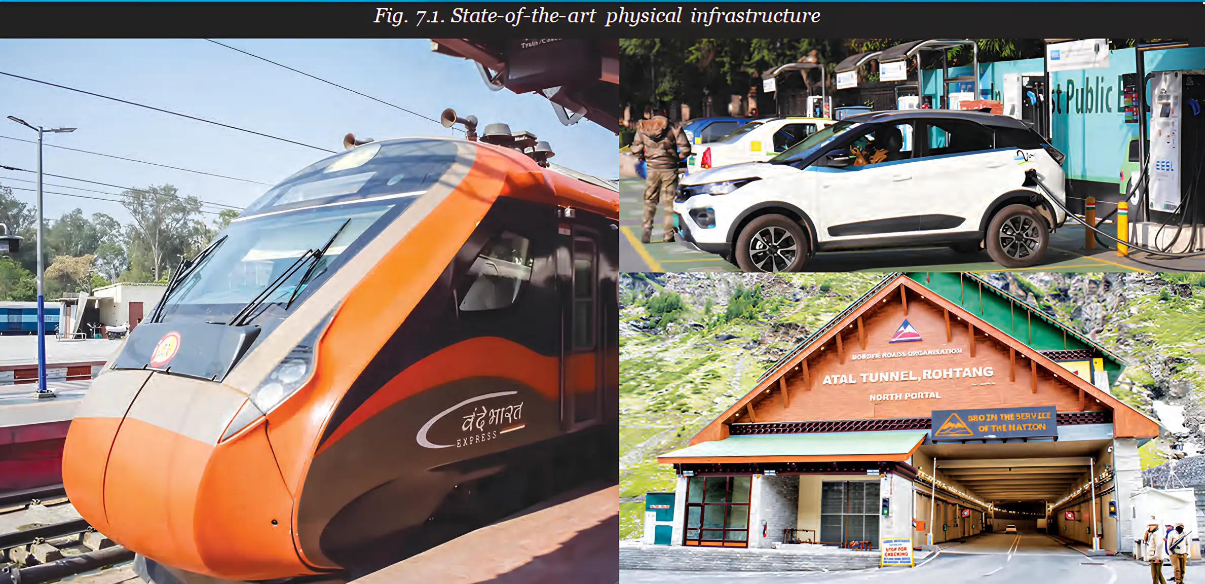
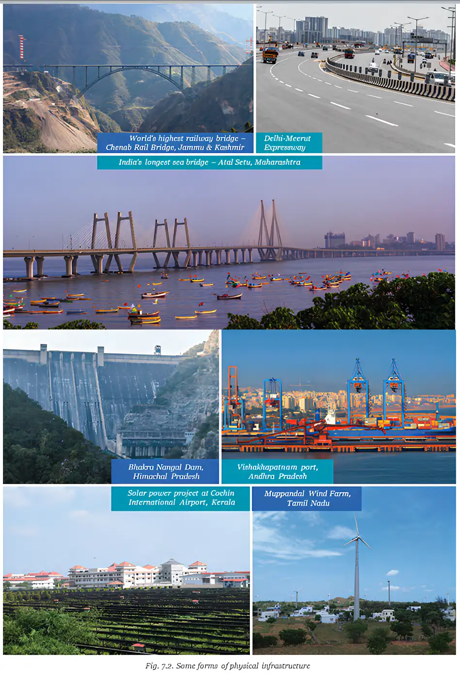
| Transport | Roads, bridges, railways, airways and shipping |
| Utilities | Electricity systems and water pipelines |
| Communication | Internet, telephone lines and telecom towers |
| Energy | Windmills, solar parks, and oil and gas pipelines |
Why Physical Infrastructure Is Important
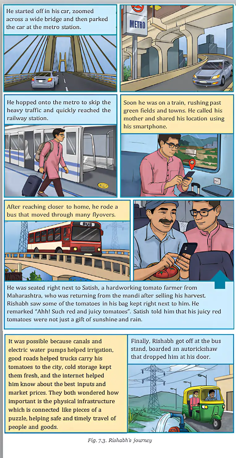
- Everyday life: Infrastructure makes life easier for individuals and communities by providing essential services and connections.
- Government and business: It enables government to function smoothly and helps businesses move goods and services.
- Trade: Roads, railways, airways and shipping connect places where goods are made with markets. Modern infrastructure extends India’s ancient trade links and boosts trade within India and abroad.
- Tourism and access: Infrastructure supports tourism and connects remote areas.
- Emergencies and security: It helps people and services respond to floods and earthquakes, and improves defence forces’ access across different terrains.
Quick recap
- Physical infrastructure is the tangible network that supports life in cities and villages.
- Its main types include transport, utilities, communication and energy systems.
- APJ Abdul Kalam’s development goal was equal infrastructure access in urban and rural areas.
- Infrastructure makes life easier, supports government and business, and connects production with markets.
- It supports trade and tourism, links remote areas, aids emergency response and strengthens national security.
Transportation Infrastructure Part-1
Road and Highway Network
Why roads matter
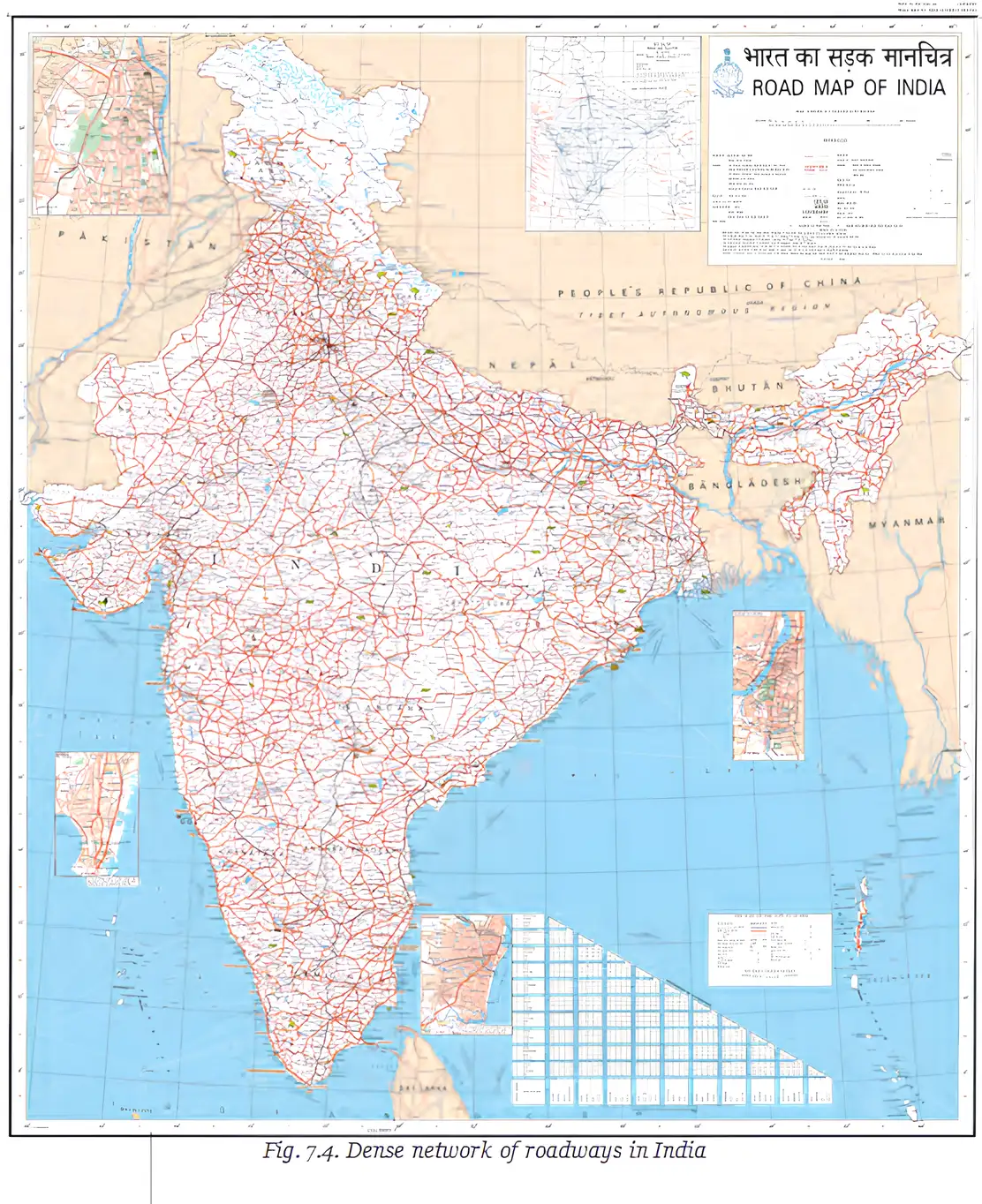
- Road network: India had the world’s second-largest road network in 2024, after the United States.
- Everyday role: Local roads help people reach school, farmers take crops to markets, and ambulances reach hospitals.
- Connections: Major roads link towns and cities and connect with railway stations, airports and ports for smoother movement of people and goods.
| Road type | Main role | Built and maintained by |
|---|---|---|
| Local roads | Connect nearby places and support daily travel and local services. | Local authorities, such as Panchayats and municipalities. |
| State highways | Connect towns and districts within a state. | State governments through public works departments. |
| National highways and expressways | Fast routes linking cities across states. | Central government. |
Road network facts
- 2024India had the world’s second-largest road network, after the United States.
- As of 2025India’s national highways totalled around 150,000 km.
Important highway networks
- NH44: India’s longest national highway, about long; it runs from Srinagar in the north to Kanyakumari in the south.
- Golden Quadrilateral: A major highway network connecting Delhi, Mumbai, Chennai and Kolkata.
Bridges and Tunnels in Difficult Terrain
Bridges and tunnels — Transport structures that help roads cross or pass through obstacles where ordinary highways are difficult to build.
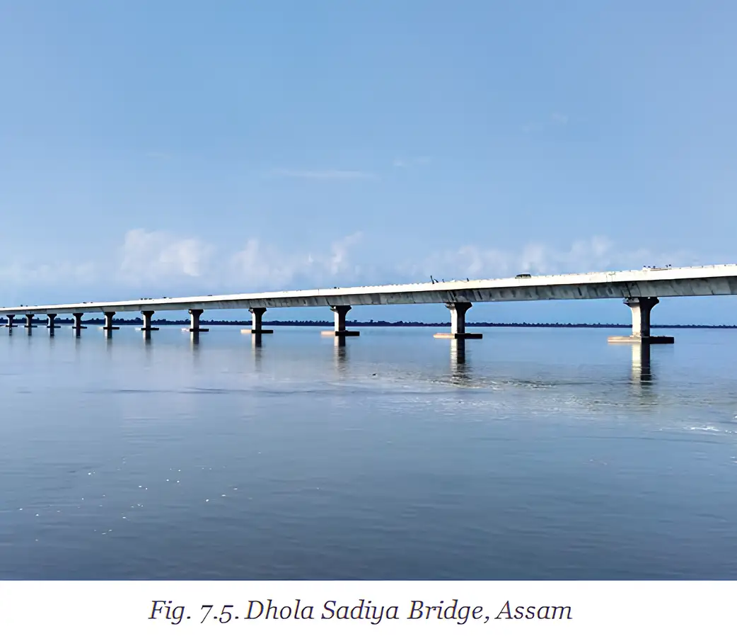
Dhola Sadiya Bridge
- Other name: Bhupen Hazarika Setu.
- Location: Connects Assam and Arunachal Pradesh across the Lohit River, a tributary of the Brahmaputra.
- Length: At , it is India’s second-longest bridge.
- Impact: It provides year-round travel, saves about four hours and helps farmers get produce to markets before it spoils.
- Access: It also makes hospitals and medicines easier to reach, including during floods.
Why the Dhola Sadiya Bridge improved travel
- Before the bridge, people depended on ferries across the river.
- Floods could stop ferry services.
- The bridge enabled year-round crossing and cut travel time by about four hours.
- People gained more reliable access to markets, hospitals and medicines.
Meghalaya’s Living Root Bridges
Living root bridge — A natural bridge formed by guiding and nurturing the growing roots of the Ficus elastica, or Indian rubber tree, across a stream.
How they are made and why they matter
- Makers: Indigenous Khasi and Jaintia communities guide tree roots across streams using bamboo and palm trunks.
- Growth: Roots strengthen and twist together over many years; some bridges take decades or centuries to mature.
- Structure: They can stand – high and may last for hundreds of years.
- Significance: These living pathways show local knowledge of nature and carry cultural meaning, connecting generations.

- State highway
- A road linking towns and districts within one state.
- National highway
- A major road route connecting cities across states.
- Golden Quadrilateral
- Highway network connecting Delhi, Mumbai, Chennai and Kolkata.
- Living root bridge
- A bridge made by guiding and nurturing tree roots across a stream.
How do the Dhola Sadiya Bridge and living root bridges improve access in different ways?
Quick recap
- India had the world’s second-largest road network in 2024; national highways totalled around 150,000 km as of 2025.
- State highways link places within a state; national highways and expressways connect cities across states.
- NH44 runs from Srinagar to Kanyakumari; the Golden Quadrilateral links Delhi, Mumbai, Chennai and Kolkata.
- Bridges and tunnels provide access where difficult terrain limits road construction.
- The Dhola Sadiya Bridge connects Assam and Arunachal Pradesh and improves year-round travel.
- Meghalaya’s living root bridges are nurtured by Khasi and Jaintia communities and can last for hundreds of years.
Transportation Infrastructure Part-2
Railways under British Rule
Why the British built railways
- Introduced: Railways began in India in 1853 under British rule.
- Exports: They carried raw materials such as cotton and tea to ports for export to Britain.
- Markets: Railways moved British goods across India, helping create markets for them.
- Control: They helped exploit resources and move troops quickly, strengthening British control over India.
Railways and British control
- Railways built to transport raw materials and British goods
- Faster movement of goods, resources and troops
- Greater exploitation of resources and tighter control over Indian territory
Growth and Importance of Indian Railways
Effects of railway expansion
- Expansion of the railway network
- Growth in trade and development of major markets
- New settlements near railway stations
- Railways become a lifeline for moving people and goods
Railways today
- Passengers: Indian Railways carries over 20 million passengers every day and is among the world’s cheapest train services.
- Freight: Cargo trains carry goods such as coal, grains, textiles and electronics.
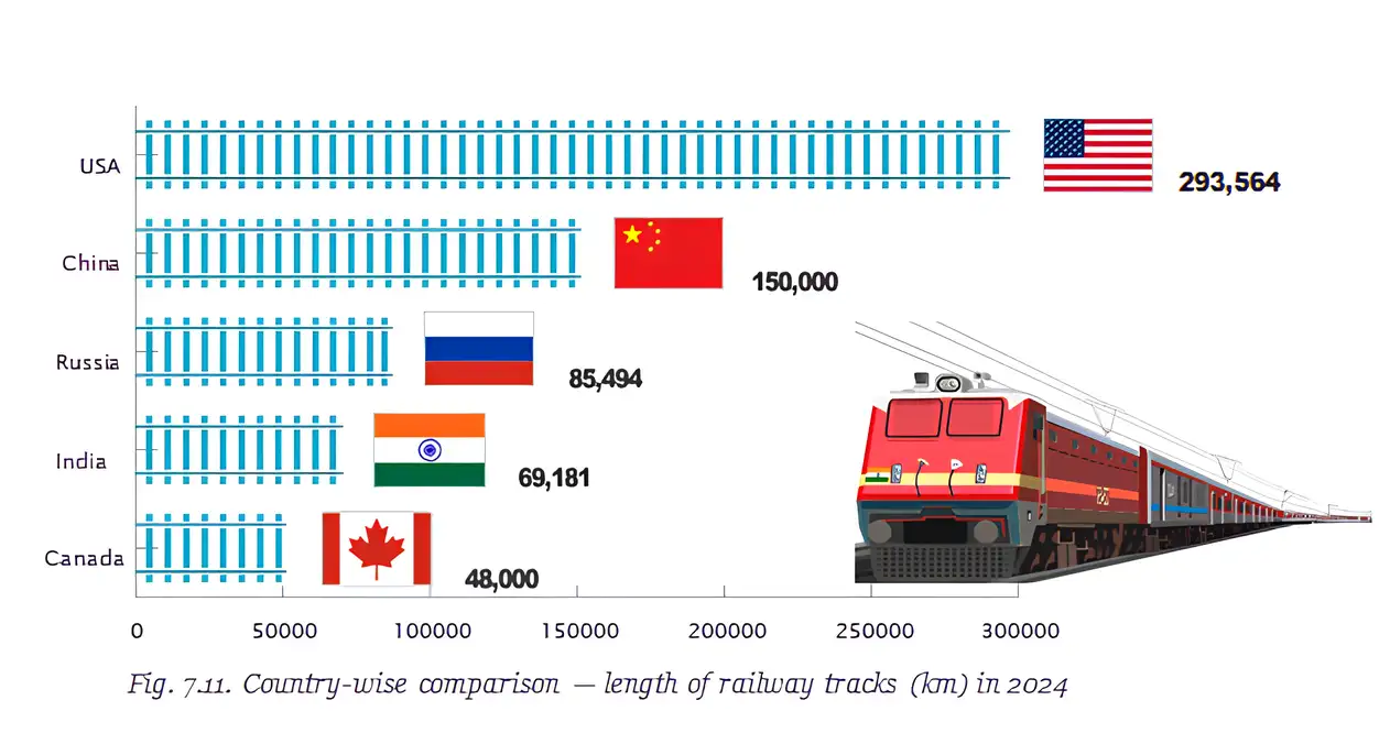
- Scale: Indian Railways is the world’s fourth-largest railway system.
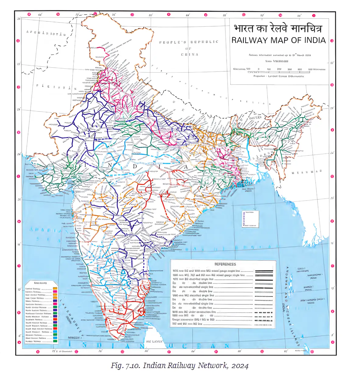
- Network: Railway routes are spread across India.
| Point | Rail freight | Road transport |
|---|---|---|
| Energy use | Uses 75–90% less energy | Uses more energy than rail for moving cargo |
Electrification and Employment
Energy and environmental impact
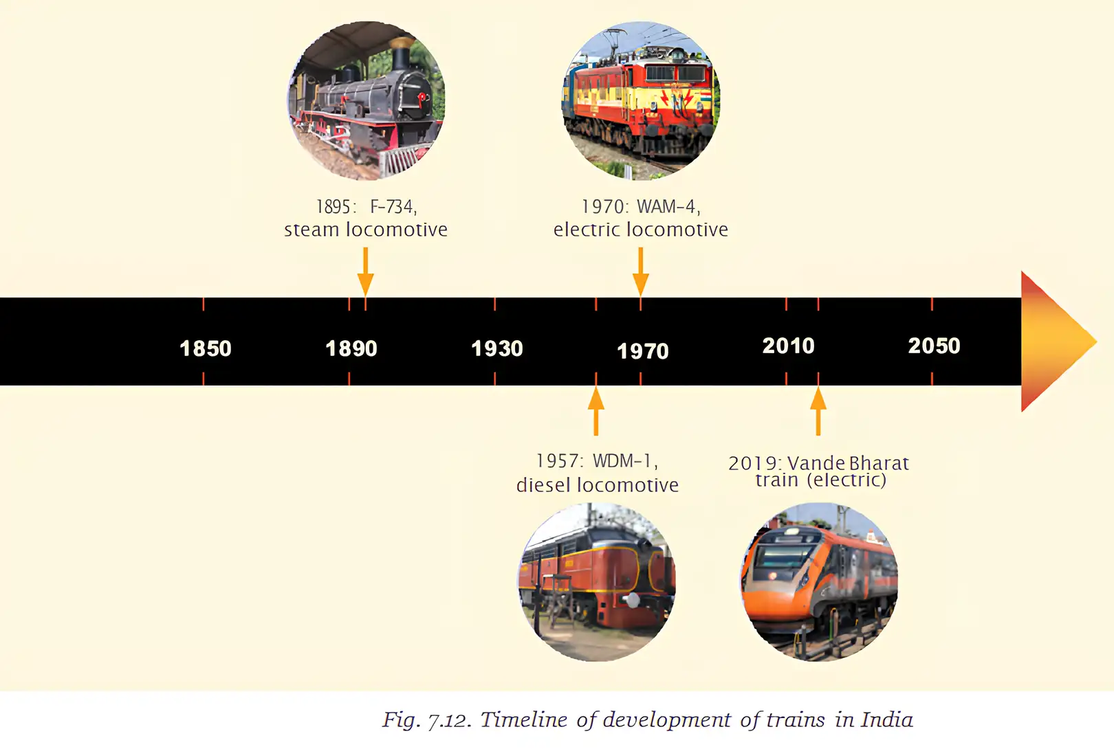
- Earlier trains: Steam trains used coal and later trains used diesel; both contributed to pollution.
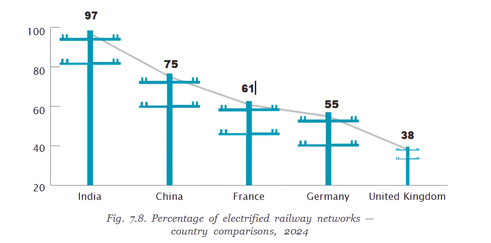
- Electrification: Electric trains are better for the environment than coal- or diesel-powered trains.
- National aim: India aimed to run 100% of its trains on electricity by 2025.
Jobs created by the railways
- Direct employment: Indian Railways had about 1.21 million employees in 2024, including engineers, ticket collectors and service staff.
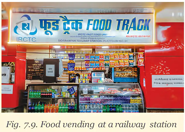
- Indirect employment: Railway activity also supports jobs in catering, vending and taxi services.
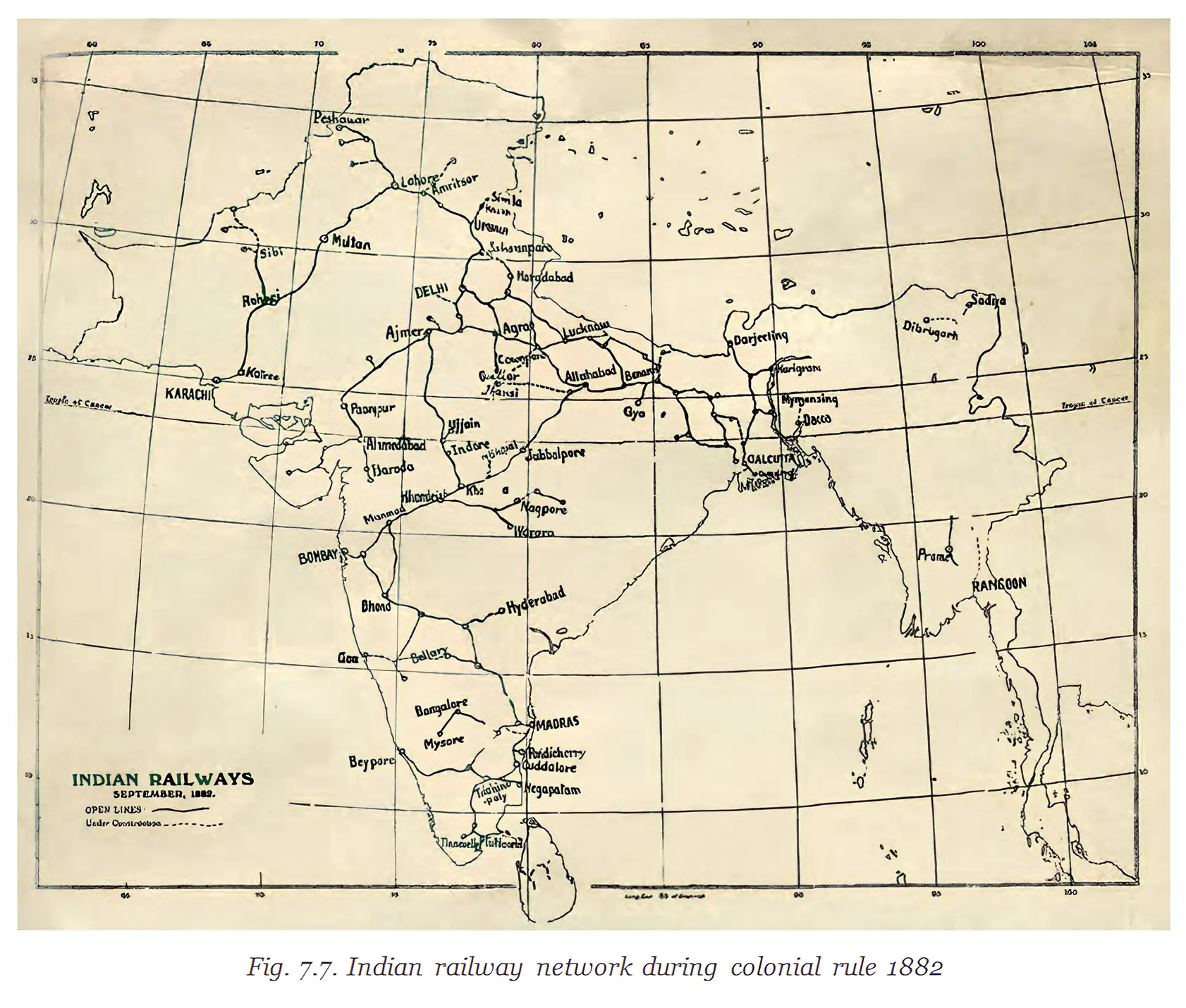
Key dates
- 1853The British introduced railways in India.
- 1882The colonial railway network is shown in a map.
- 2024Indian Railways had about 1.21 million employees; railway electrification was also compared internationally.
- By 2025India aimed to have all trains running on electricity.
- Railway network
- The connected system of railway routes across a region or country.
- Freight
- Goods transported by a vehicle or transport system.
- Electrification
- The process of powering railway trains using electricity.
- Indirect employment
- Jobs supported by railway services but not directly within the railway workforce.
Why did the British develop railways in India?
How does rail transport support trade and employment?
Quick recap
- Origin: British railways began in India in 1853 to move goods, raw materials and troops.
- Expansion: Railways encouraged trade, markets and settlements and became vital for moving people and goods.
- Scale: Indian Railways carries over 20 million passengers daily and is the world’s fourth-largest railway system.
- Freight: Rail cargo uses 75–90% less energy than road transport.
- Electrification: Trains once used coal and diesel; India aimed for all trains to run on electricity by 2025.
- Employment: About 1.21 million people worked for Indian Railways in 2024, alongside many indirect jobs.
Transportation Infrastructure Part-3
Metro Train Systems
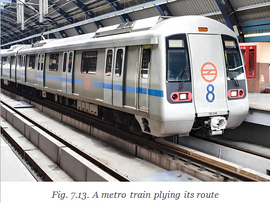
Metro train system — An urban rail network that carries commuters on underground or elevated tracks.
Key features and benefits
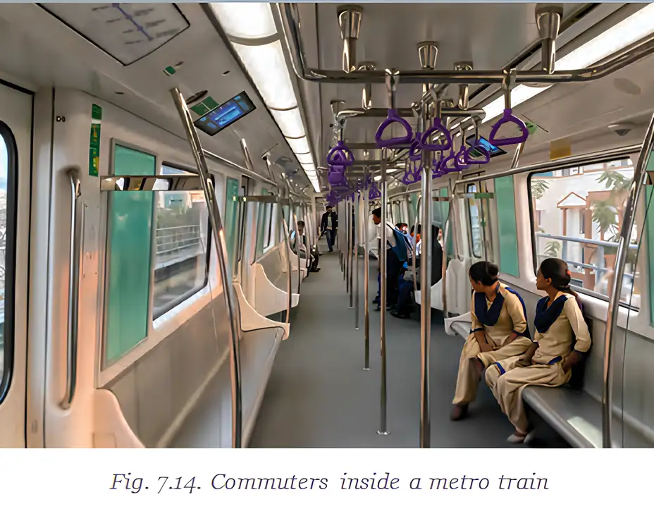
- Network: Metro trains operate in 23 Indian cities, covering over 1,000 km in total.
- Expansion: India’s metro network is expanding and is expected to become the world’s third-largest, after China and the USA.
- Commuting: Fast, reliable services make daily travel easier, reduce road traffic and cut travel time.
- Environment: Metro trains use cleaner electricity; some systems, including the Delhi Metro, also use solar power.
Air Transport
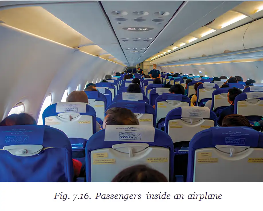
Air transport — The fastest way to connect people and places within a country and across countries.
| Type | Main purpose | Examples |
|---|---|---|
| Passenger flights | Carry people between places. | Passengers travelling within or across countries. |
| Cargo flights | Carry goods, especially high-value or perishable items. | Vaccines, chemicals and seafood. |
Uses and reach
- Disaster relief: Aircraft can deliver aid during floods and earthquakes.
- Access: Air transport can reach difficult terrain, including high mountains, deserts, dense forests and long oceanic stretches.
- India’s air traffic: India has the world’s third-highest domestic air traffic, after the USA and China; it handled around 376 million passengers in 2024–25.
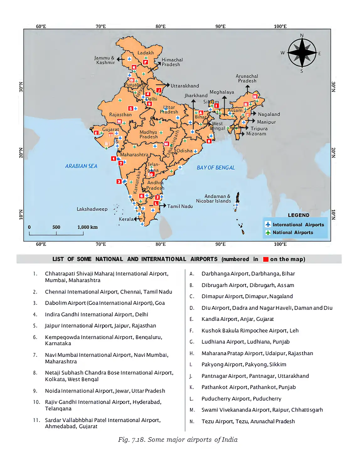
- Airports: India had 159 airports in 2025, including international and domestic airports.
Kempegowda International Airport
- Location: Bengaluru, Karnataka.
- Design: Based on the “garden city” concept, with bamboo structures, plants and green spaces.
- Infrastructure: Combines nature-inspired design with the latest infrastructure to serve passengers.

- Metro network
- Urban rail system using underground or elevated tracks.
- Cargo flight
- An aircraft service that transports goods.
- Domestic air traffic
- Air travel taking place within a country.
Quick recap
- Metro trains provide fast, reliable urban travel and help reduce road traffic.
- India’s metro network operates in 23 cities and extends over 1,000 km.
- Electricity and, in some cases, solar power make metro systems cleaner.
- Air transport is the fastest way to connect places and carries passengers, goods and disaster aid.
- India had 159 airports in 2025 and handled around 376 million passengers in 2024–25.
- Kempegowda International Airport combines modern passenger infrastructure with a garden-city design.
Transportation Infrastructure Part-4
Shipping and Ports
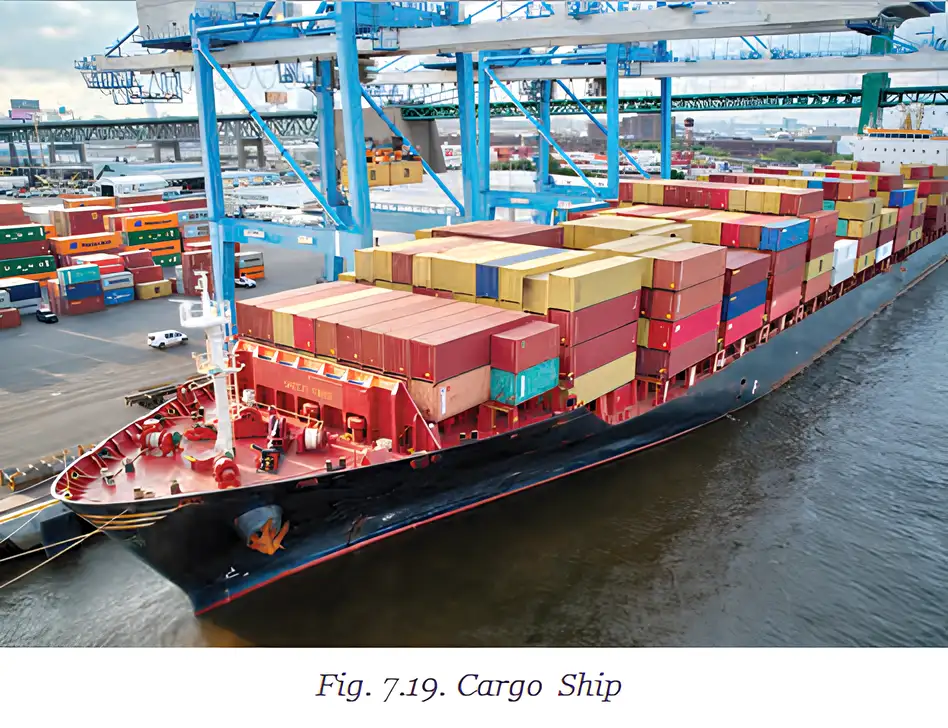
Shipping — The transport of goods by ships, especially over long distances.
Why shipping matters
- Coastline: India has approximately 11,100 km of coastline, connecting it by sea to regions such as West Asia, Africa and Europe.
- Cost and capacity: Ships are a cheaper transport option and can carry heavy goods over long distances.
- Examples of cargo: Coal, cars and cement are transported by ship.
- Ports: Ships dock at ports, where goods are loaded and unloaded.
| Port category | Number in India |
|---|---|
| Major ports | 12 |
| Minor ports | 217 |
Cargo handled
- Growth: The volume of cargo handled by Indian ports increased by 50% over the past decade.
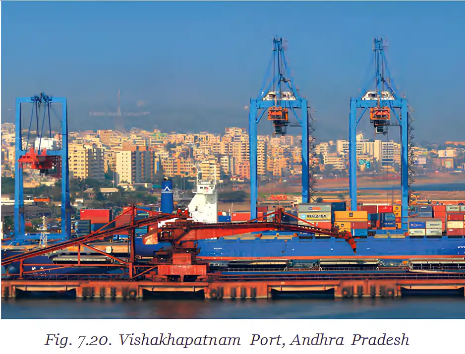
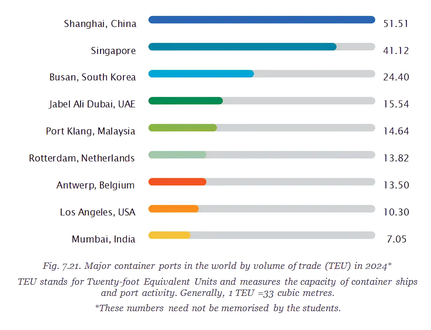
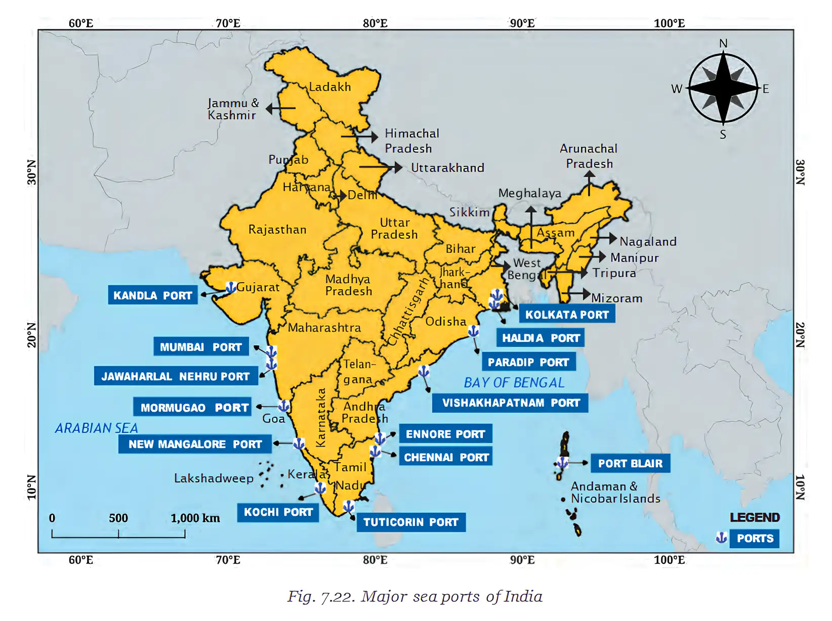
- Port
- A place where ships dock and goods are loaded or unloaded.
- TEU
- A unit used to compare container-port trade volumes.
Quick recap
- India’s approximately 11,100 km coastline supports shipping links with West Asia, Africa and Europe.
- Shipping is a relatively cheap way to move heavy goods over long distances.
- Ships carry goods such as coal, cars and cement.
- Ports are places where ships dock and cargo is loaded or unloaded.
- India has 12 major ports and 217 minor ports.
- The volume of cargo handled increased by 50% over the past decade.
Communications Infrastructure
Communication Infrastructure
- Connectivity: Communication infrastructure enables people and organisations to exchange information quickly.
- Benefits: It supports online learning, emergency alerts, e-commerce, digital payments and e-governance.
- Reach: Improved communication helps connect communities, including those in remote areas.
How a Digital Message Travels
Voice-note journey
- Electricity powers the nearby mobile tower.
- The message travels through fibre cables and communication links.
- It may pass through satellites and servers in distant cities.
- The network delivers the voice note to the recipient’s phone.
Uses and Benefits
- E-governance
- Use of communication technologies by the government to deliver services to citizens; for example, DigiLocker stores documents such as Aadhaar cards and driving licences online.
- E-commerce
- Buying or selling products and services through online platforms or the internet.
- Patent
- A right granted by the government or an institution that gives a person or company exclusive rights to make, sell or use an invention for a set period.
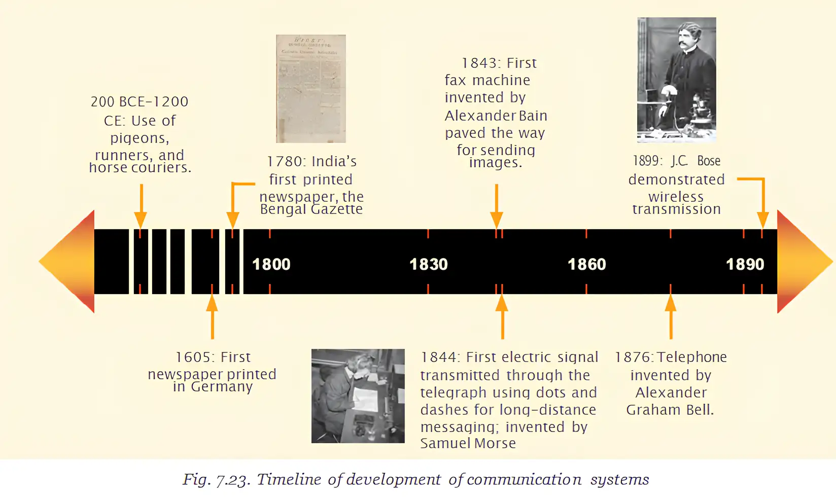
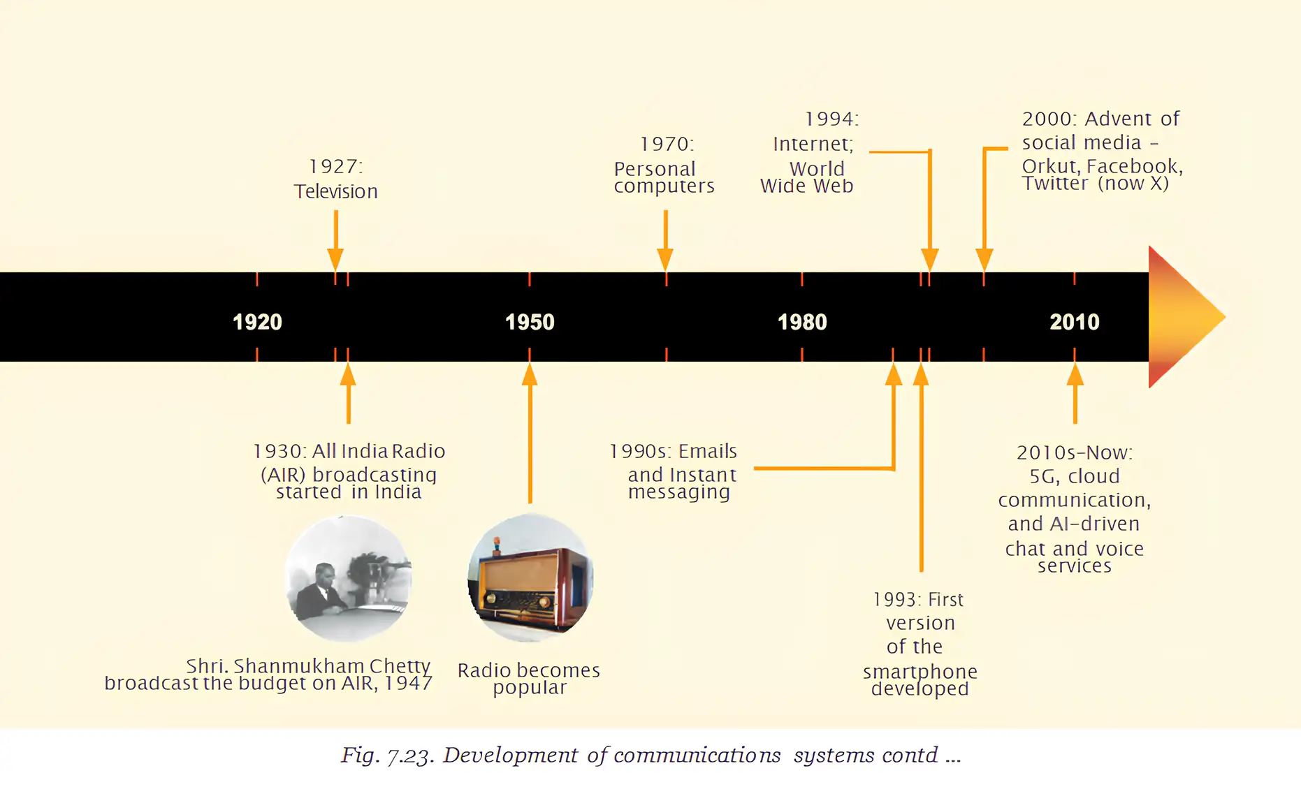
Pioneers of Wireless Communication
Bose and Marconi
- Guglielmo Marconi was an Italian physicist and inventor who patented a similar device in 1901 and transmitted a radio signal across the Atlantic that year.
- 1909: Marconi received the Nobel Prize in Physics.
Key Dates
- 1858–1937Life of Jagadish Chandra Bose.
- 1895Bose demonstrated wireless signal transmission through a wall in Calcutta.
- 1901Marconi patented a similar device and transmitted a radio signal across the Atlantic.
- 1909Marconi received the Nobel Prize in Physics.
- 1917Bose established the Bose Institute.
Communication Infrastructure in India
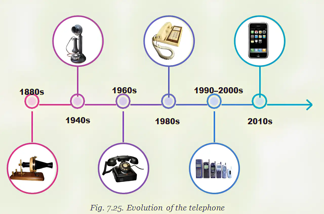
Social Infrastructure
What is communication infrastructure? Give two examples of its components.
State two contributions of Jagadish Chandra Bose to wireless communication.
Quick recap
- Communication infrastructure connects devices through cables, towers, satellites and data centres.
- Digital communication carries information rapidly over long distances and supports education, emergency response and business.
- E-governance uses communication technology to provide government services; e-commerce enables online buying and selling.
- J.C. Bose pioneered wireless transmission and invented several early wireless devices; Marconi patented a similar device and sent a radio signal across the Atlantic in 1901.
- Bose’s galena crystal detector was an early semiconductor; galena is a common lead ore.
- In 2025, India had 1,160 million wireless telephone subscribers and nearly 900 million internet connections.
- Social infrastructure includes facilities such as schools, hospitals and libraries that support community wellbeing.
Collective Responsibility Towards Infrastructure
Taking Care of Public Infrastructure
Collective responsibility — Maintaining public infrastructure is a shared duty of citizens and authorities.
Why public infrastructure needs care
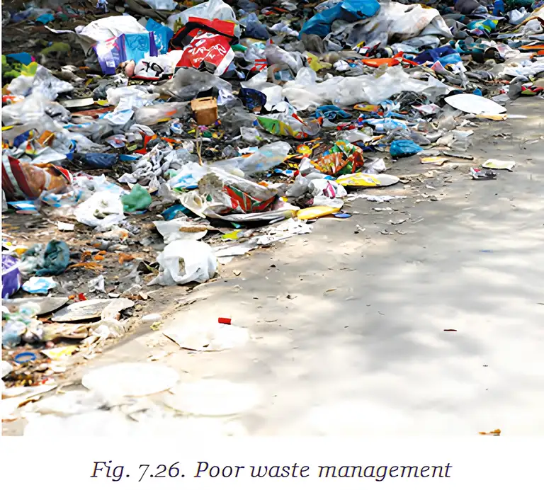
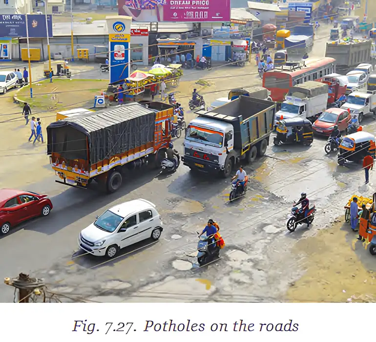
- Damage: Litter, stains and damage to public places make life harder and create costs that affect every citizen.
- Citizen role: Use public infrastructure responsibly and report damage, such as potholes or broken streetlights, to the authorities.
Improving Services and Designing Better Infrastructure
Key priorities
- Local services: Panchayats and municipalities need to improve waste management, sewer systems and traffic management.
- Essential access: Services should provide clean, safe drinking water and pedestrian-friendly footpaths.
- Sustainability: Use cleaner energy and environment-friendly materials to reduce pollution and harm to biodiversity.
- Example: Solar panels can generate electricity for buildings and reduce emissions.
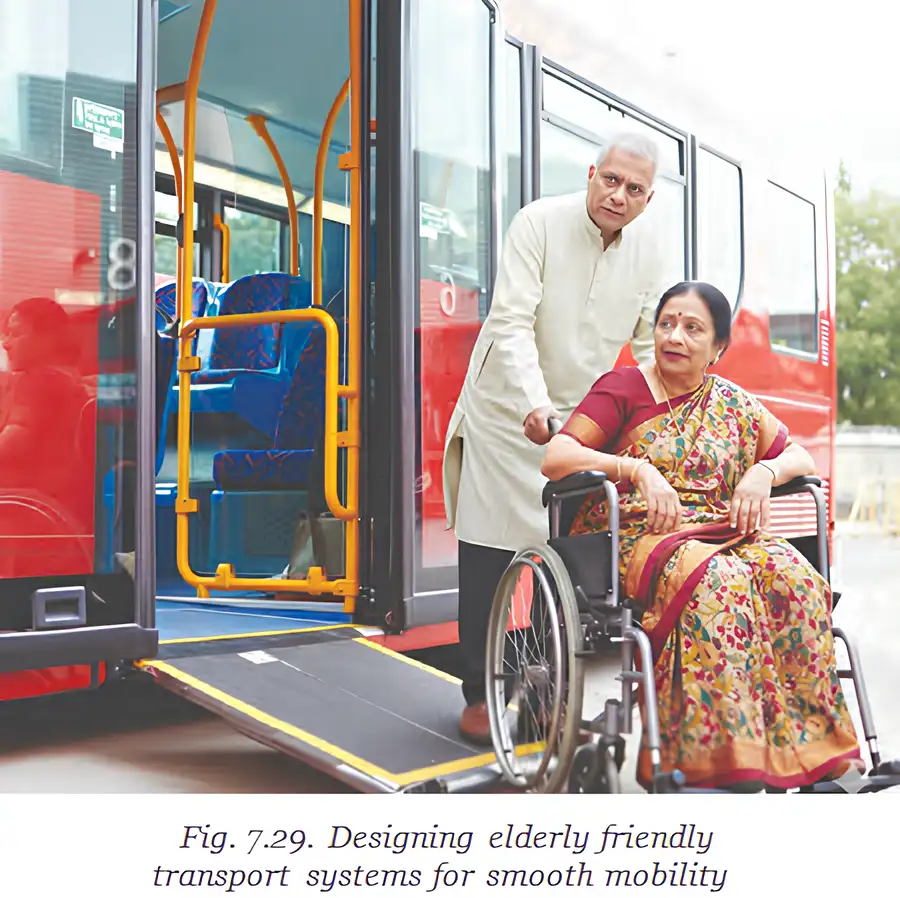
- Inclusive design: Infrastructure should consider the needs of children, elderly people and people with disabilities.
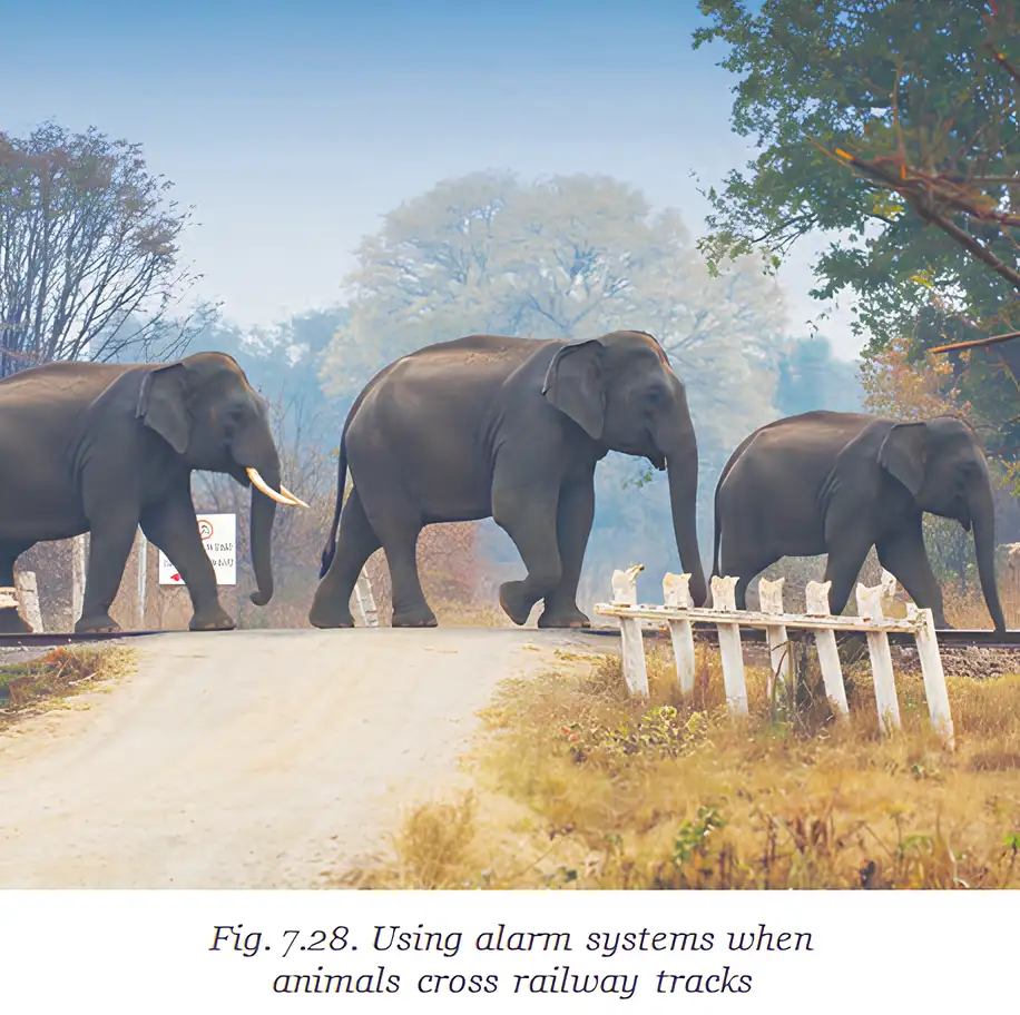
Infrastructure in the Arthashastra
Roles and road planning
- Shared role: Kautilya’s Arthashastra describes the state, grama and sabhas as actively involved in developing and maintaining roads and waterways.
- Planning: Roads connected towns, villages and neighbouring countries; their widths differed according to the type of road and traffic.
| Road type | Width |
|---|---|
| Royal highways, countryside roads, port-town roads and roads leading to villages | 16 m |
| Forest roads and roads within cities | 8 m |
| Chariot roads | 2.5 m |
Preventing damage
- Penalties: The Arthashastra recommends punishments and fines for people who damage or misuse public infrastructure.
- Waterworks: Breaking a reservoir dam was to receive a severe penalty.
- Public spaces and paths: Fines were recommended for breaking a public-park hedge to trespass, or obstructing paths to waterworks and forests.
- Grama
- A village community or village-level body.
- Sabhas
- Assemblies that participated in developing and maintaining infrastructure.
- Waterworks
- Public works and structures that support water supply or management.
What road-width standards are given in the Arthashastra?
Quick recap
- Caring for public infrastructure is a shared responsibility of citizens and authorities.
- Panchayats and municipalities need to improve waste, sewer, traffic, water and footpath services.
- Sustainable infrastructure uses cleaner energy and environment-friendly materials; solar panels can reduce emissions.
- Infrastructure should be safe and accessible for children, elderly people and people with disabilities.
- The Arthashastra describes road-width standards and penalties for damaging infrastructure.
- Citizens should use infrastructure responsibly and report damage to authorities.
Before we move on
Infrastructure and Development
- Backbone: Quality infrastructure enables economic activities and improves connectivity and ease of living.
- Economic growth: Transport links places of production with markets, supporting trade, businesses and employment.
- Wider benefits: Infrastructure supports tourism, connects remote areas and helps during emergencies.
- National development: Better access across different terrains also strengthens national security.
- Shared goal: A developed India should provide urban and rural areas with comparable roads, power, water and communication.
Quick recap
- Quality infrastructure supports a country’s economic activities.
- It improves connectivity and creates employment opportunities.
- Good infrastructure enhances ease of living.
- India’s physical infrastructure has grown greatly over time.
- Citizens share the responsibility to preserve and maintain infrastructure.
Social Science — ALL CHAPTERS
1
Geographical Diversity of India
2
Understanding the Weather
3
Climates of India
4
New Beginnings Cities and States
5
The Rise of Empires
6
The Age of Reorganisation
7
The Gupta Era: An Age of Tireless Creativity
8
How the Land Becomes Sacred
9
From the Rulers to the Ruled: Types of Governments
10
The Constitution of India - An Introduction
11
From Barter to Money
12
Understanding Markets
1
The Story of Indian Farming
2
India and Her Neighbours
3
Empires and Kingdoms: 6th to 10th Centuries
4
Turning Tides: 11th and 12th Centuries
5
India, a Home to Many
6
The State, the Government, and You
7
Infrastructure: Engine of India’s Development
8
Banks and the Magic of Finance