Class 7 . Social Science . Exploring Society India and Beyond Part II . India and Her Neighbours
Chapter 2: India and Her Neighbours
Ch 2
Social Science
Class 7
Framing the Neighbourhood
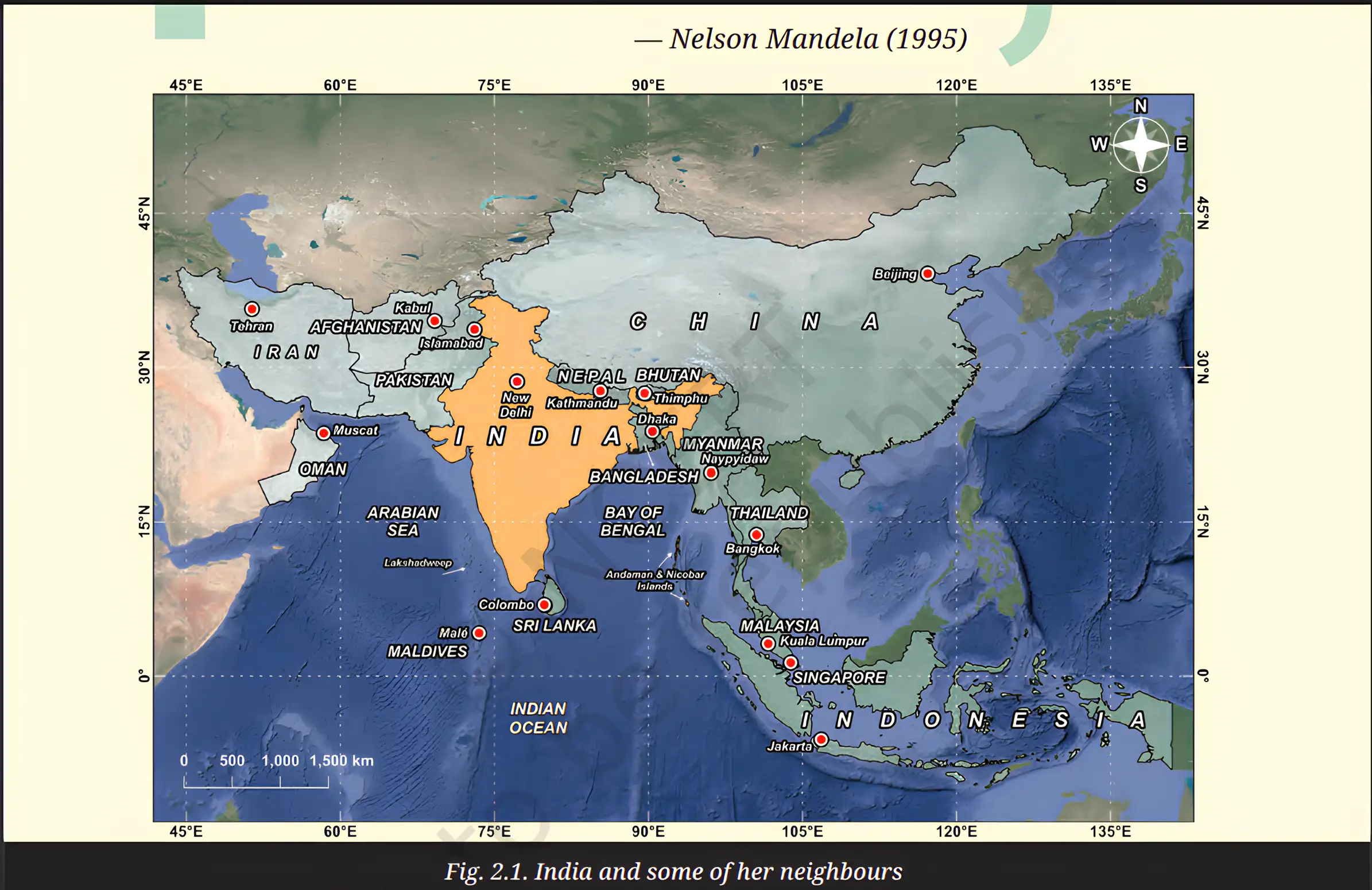
Who Is a Neighbour?
Neighbour — A neighbour is not only a country sharing a land boundary; countries connected by the sea can also be neighbours.
| Point | Land neighbourhood | Maritime neighbourhood |
|---|---|---|
| Connection | Countries are connected by a land boundary. | Countries are connected across a shared sea or ocean, even without a land border. |
| Examples near India | Pakistan, Afghanistan, China’s region of Tibet, Nepal, Bhutan, Bangladesh and Myanmar. | Sri Lanka and the Maldives; the wider maritime neighbourhood includes Iran, Oman, Thailand, Malaysia, Singapore and Indonesia. |
India’s Neighbourhood
- Land boundary: India’s land boundary stretches for over 15,100 km through deserts, plains, forests, mountains, marshes and river valleys.
- Sea links: India is surrounded by the sea on three sides, making it a maritime nation.
- Wider region: India’s location gives it a central and strategic position in South Asia.
India’s Maritime Position
The Indian Ocean and India
- Surrounding waters: The Arabian Sea, the Bay of Bengal and the Indian Ocean border India.
- Coastline: India has an approximately 11,100 km coastline, and its peninsula extends deep into the Indian Ocean.
- Ocean importance: The Indian Ocean is the world’s third-largest ocean and a major route for global shipping.
- Global traffic: Around half of the world’s container ships, one-third of its bulk cargo and two-thirds of its oil are transported through the Indian Ocean.
- People connected: Countries around this ocean are home to about 2.7 billion people.
How India’s Location Connects the Region
- India’s peninsula extends into the Indian Ocean.
- This gives India access to important sea routes.
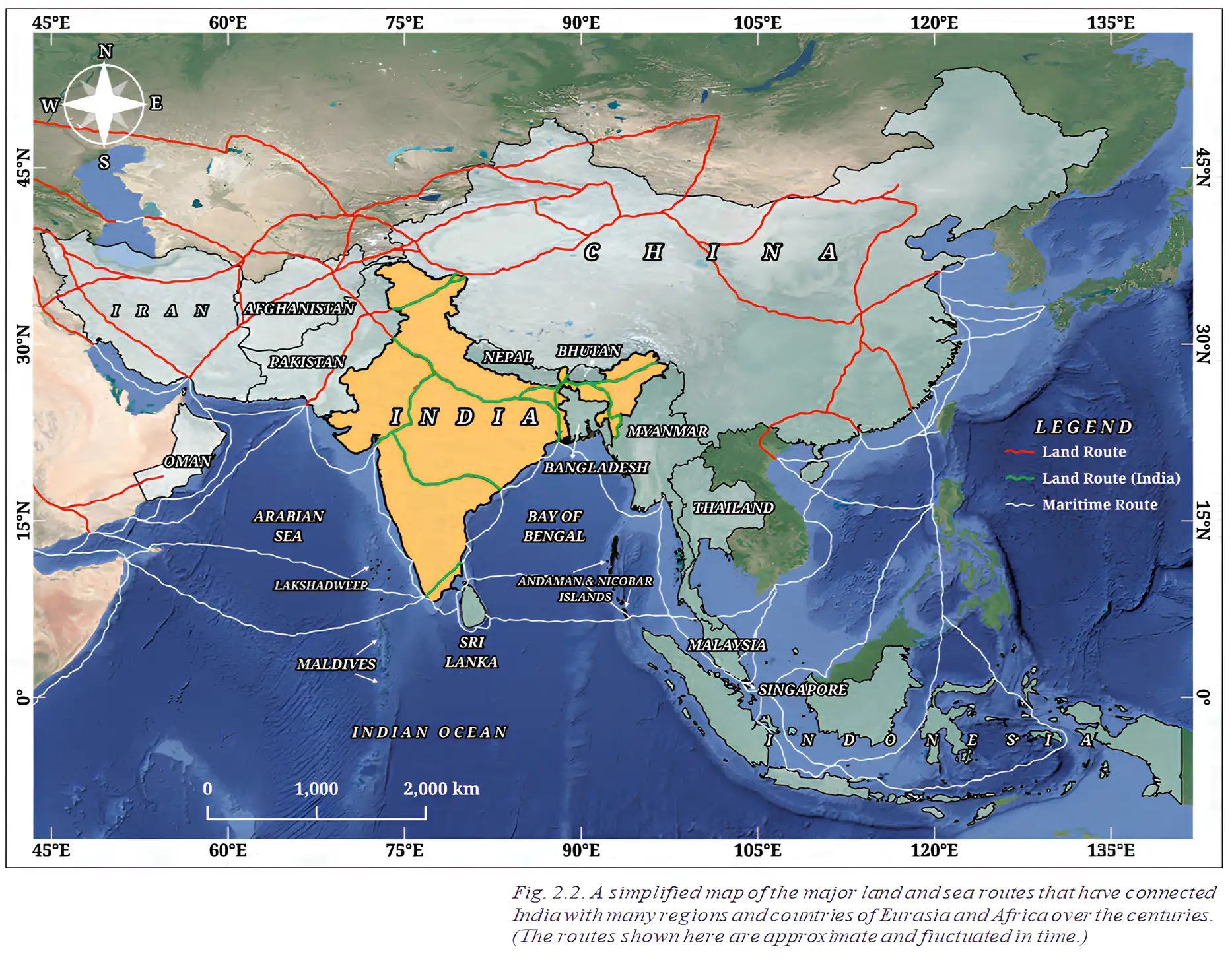
- India links Southeast Asia, West Asia and Africa through trade and regional cooperation.
- Ports support imports and exports, while India’s central position helps it provide timely humanitarian aid and disaster relief.
Regionalism — Regionalism is cooperation among countries in a region for shared benefits and progress.
Why Neighbourly Cooperation Matters
- Beyond borders: Being good neighbours involves working together, not just sharing boundaries.
- Shared outcomes: Regional cooperation can support peace, stability and shared progress.
- Long-standing links: Sea routes have enabled trade, cultural exchange and historical ties for centuries.
- Maritime neighbour
- A country connected to another by a shared sea or ocean, even without a direct land border.
- Maritime neighbourhood
- The wider set of countries linked to India through nearby seas and ocean routes.
- Regionalism
- Cooperation among countries in a region to promote shared benefits and progress.
Why is India considered a maritime nation with a strategic position?
How does India’s location help regional cooperation?
Quick recap
- Neighbourhood includes both countries sharing land borders and countries linked by sea.
- India’s land boundary is over 15,100 km long; its coastline is approximately 11,100 km.
- The Indian Ocean connects India with regions including Southeast Asia, West Asia and Africa.
- The Indian Ocean carries a large share of global container shipping, bulk cargo and oil.
- India’s trade, aid and disaster-relief links support regional cooperation.
- Regionalism promotes peace, stability and shared progress.
India and Her Land-based Neighbours Part-1
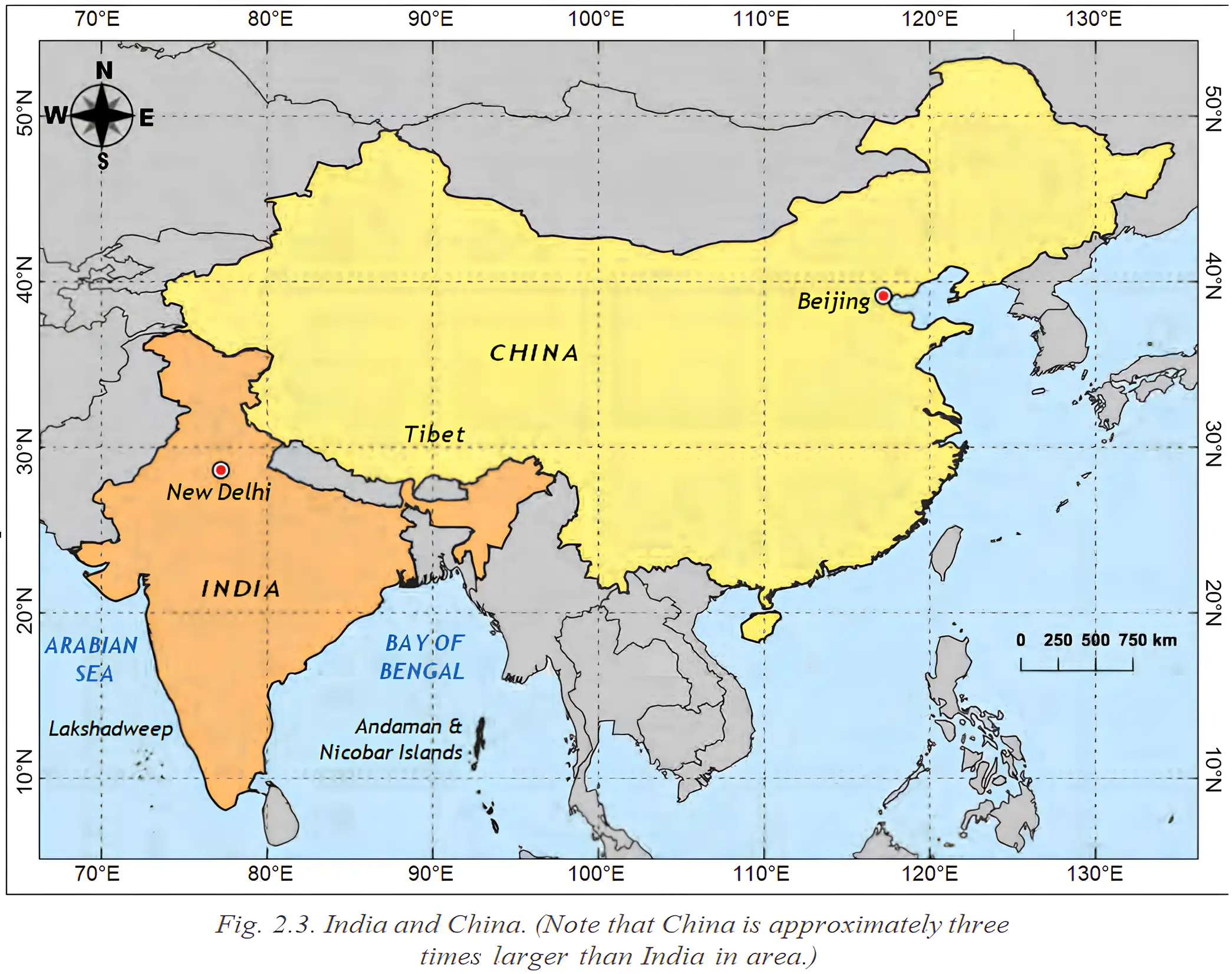
India and China
Cultural and trade connections
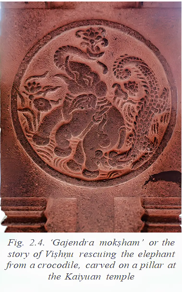
- Trade links: In the 13th century, Hindu merchants built temples in Quanzhou, an important Chinese port city.
- Temple carvings: Pillars at Kaiyuan Temple depict Viṣhṇu, Shiva and stories from the Rāmāyaṇa and Purāṇas.
- Current trade: India exports iron ore, chemicals and cotton yarn to China; it imports electronic goods and industrial equipment.
- Trade imbalance: China’s exports to India are worth about eight times India’s exports to China; companies from both countries operate in the other.
Relations and tensions
- Tensions: Recent periods of heightened tension have mainly concerned the shared border; the countries have also experienced serious conflicts.
- Dialogue: Trade, discussion and border-resolution mechanisms are among the efforts to address disputes.
India and Pakistan
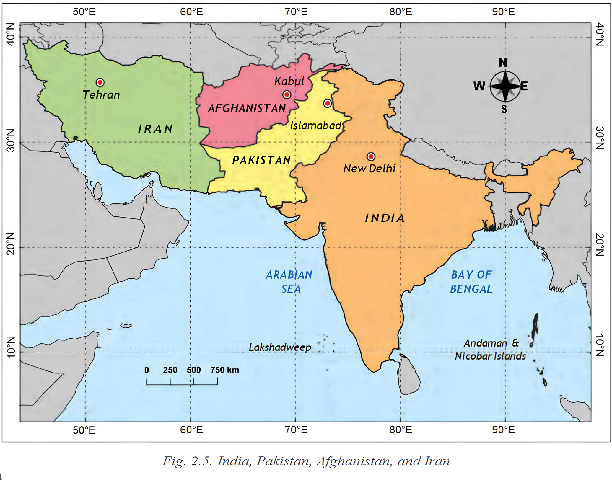
Shared heritage and peace efforts
- Shared culture: Languages, cuisines, music and festivals continue to connect people across the border.
- Religious sites: Pakistan’s Katas Raj temple complex is linked to the Mahābhārata and includes a sacred pond; Hinglaj Mata Mandir in Balochistan is another important shrine.
- Pilgrimage: Periods of peace have included trade and the opening of routes for Hindu and Sikh pilgrims.
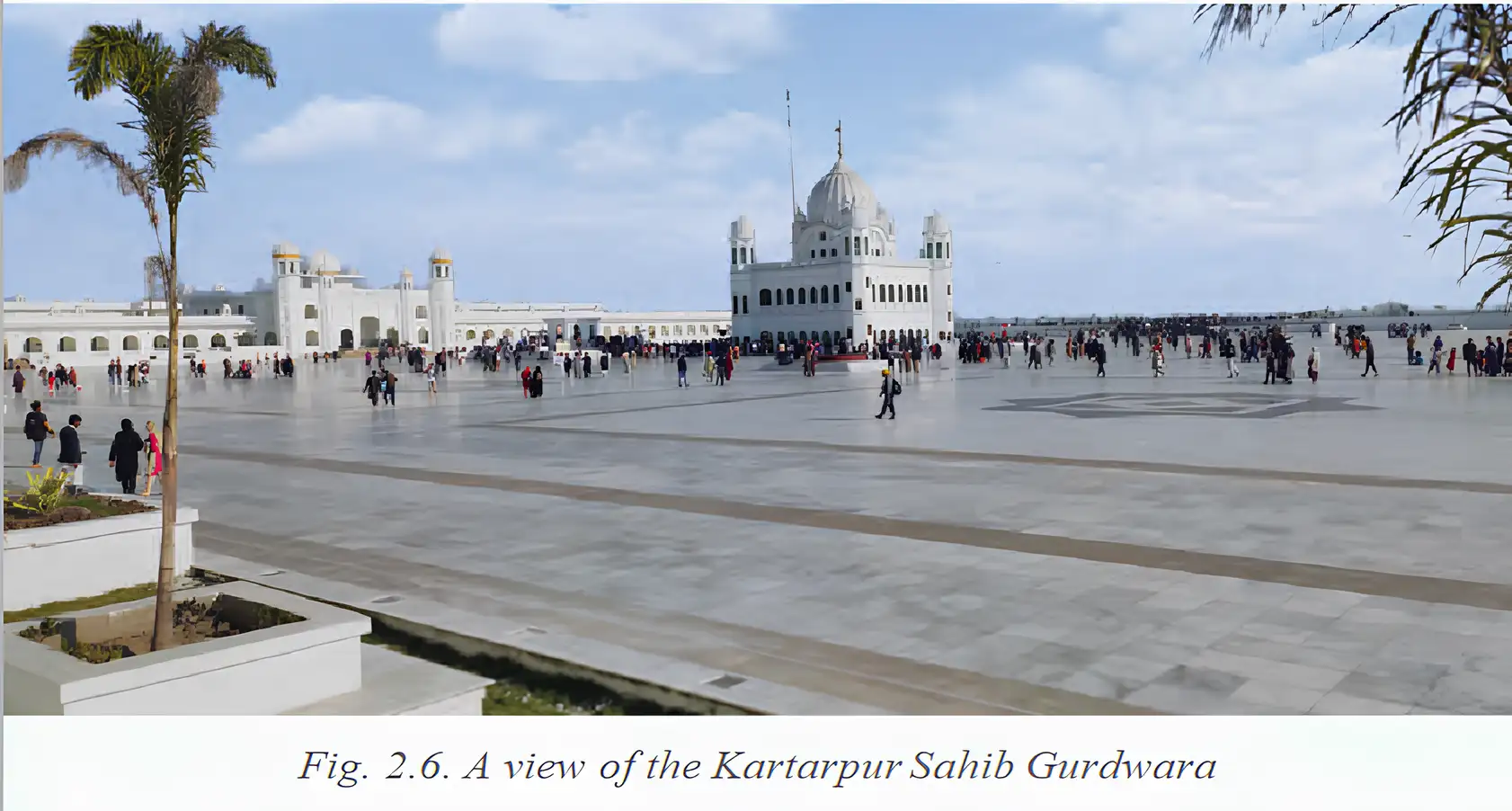
Kartarpur Corridor — A visa-free border crossing that allows Indian pilgrims to visit Gurdwara Darbar Sahib in Kartarpur, Pakistan, using a permit rather than a visa.
Why Kartarpur is significant
- Religious importance: Gurdwara Darbar Sahib is the final resting place of Guru Nānak Dev, the founder of Sikhism, who spent the last 18 years of his life there.
- Access: Before the corridor opened, Indian devotees could view the site from near Dera Baba Nanak in Punjab.
- Purpose: The corridor makes pilgrimage easier and provides a practical example of religious access and dialogue.
Key dates and periods
- Around the 1st century CEBuddhism reached China from India through trade and pilgrimage routes.
- 13th centuryHindu merchants built temples in Quanzhou, China.
- Since 1950India and China have shared a relationship shaped by history, geography, culture, trade and politics.
- 1947Partition divided British India; Pakistan had previously been part of India.
- 1948, 1965 and 1971India and Pakistan fought wars in these years.
- 1990sThe idea of a Kartarpur Corridor was proposed.
- 1999The Kargil War took place.
- 2019The Kartarpur Corridor officially opened, marking Guru Nānak’s 550th birth anniversary.
- 2024–2025India’s chief exports to China included iron ore, chemicals and cotton yarn; imports included electronic items and industrial equipment.
- Partition
- The 1947 division of British India, which created Pakistan.
- Trade imbalance
- A difference between the value of a country’s exports and imports; China’s exports to India are worth about eight times India’s exports to China.
- Kartarpur Corridor
- A visa-free crossing for Indian pilgrims travelling to Gurdwara Darbar Sahib in Pakistan; a permit is required.
Name the Indian states and Union Territory along the India–China border from east to west.
What makes the Kartarpur Corridor important to Sikh pilgrims?
Quick recap
- India and China share Himalayan borders, Buddhist connections, trade and periods of tension.
- China exports to India are worth about eight times India’s exports to China.
- The 1947 Partition and later wars have shaped India–Pakistan relations.
- India’s border with Pakistan runs through Gujarat, Rajasthan, Punjab, Jammu and Kashmir, and Ladakh.
- Shared religious sites, languages and traditions preserve cultural links across the India–Pakistan border.
- The Kartarpur Corridor, opened in 2019, enables visa-free pilgrimage with a permit.
India and Her Land-based Neighbours Part-2
India and Bangladesh
Shared history, language and geography
- History: Bangladesh, formerly East Pakistan, became an independent country in 1971 after a war between India and Pakistan.
- Language: Bangla is shared by Bangladesh and the Indian state of West Bengal.
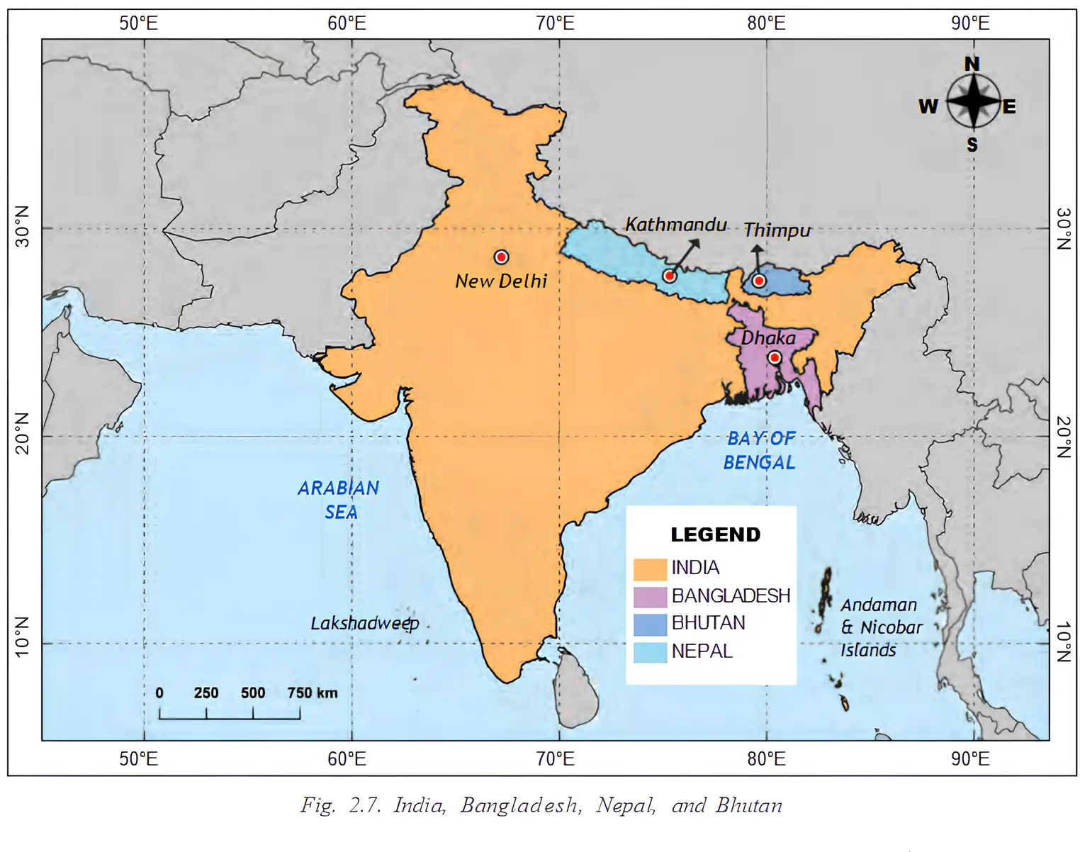
- Border: India’s land border with Bangladesh is longer than its border with China; it runs along West Bengal, Assam, Meghalaya, Tripura and Mizoram.
- Rivers: The countries share river systems originating from the Ganga and Brahmaputra, which support agriculture, fisheries, transport and livelihoods.
Bangladesh’s formation
- 1971Bangladesh emerged from formerly East Pakistan after a war between India and Pakistan.
Cooperation and the Sundarbans
- Cooperation: India and Bangladesh have strong diplomatic, economic, strategic and cultural ties.
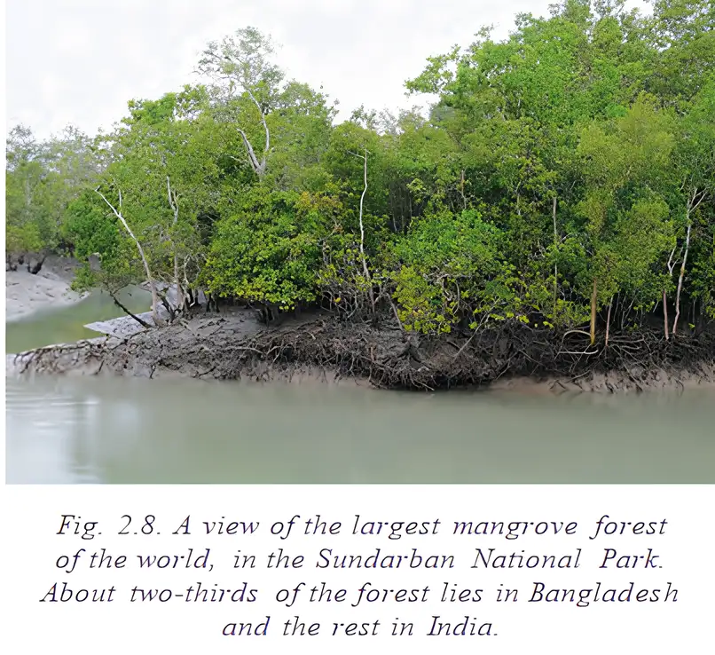
- Shared coastline: The countries share a maritime environment and coordinate the protection and management of the Sundarban National Park.
- Importance: The Sundarbans is a UNESCO World Heritage Site, home to Bengal tigers and other species, and a natural barrier against cyclones.
- Climate risks: Global warming and climate change are expected to contribute to rising sea levels and increasingly intense cyclones, threatening homes and livelihoods in Bangladesh.
Climate risks for Bangladesh
- Global warming and climate change
- Rising sea levels and increasingly intense cyclones
- Homes and livelihoods in Bangladesh affected
India and Nepal
Geography and cultural links
- Border: Nepal shares a long, open border with India across Uttarakhand, Uttar Pradesh, Bihar, West Bengal and Sikkim.
- Shared ties: Geographical proximity has supported centuries of interaction, shared heritage, spiritual connections, cross-border movement and political partnerships.
- Pilgrimage: The Pashupatinatha Temple in Kathmandu is a major Hindu pilgrimage site visited by many Indians.
- Festivals: Daśhain (Dashahara), Tihar (Dīpāvalī) and Holi are celebrated enthusiastically in both countries.
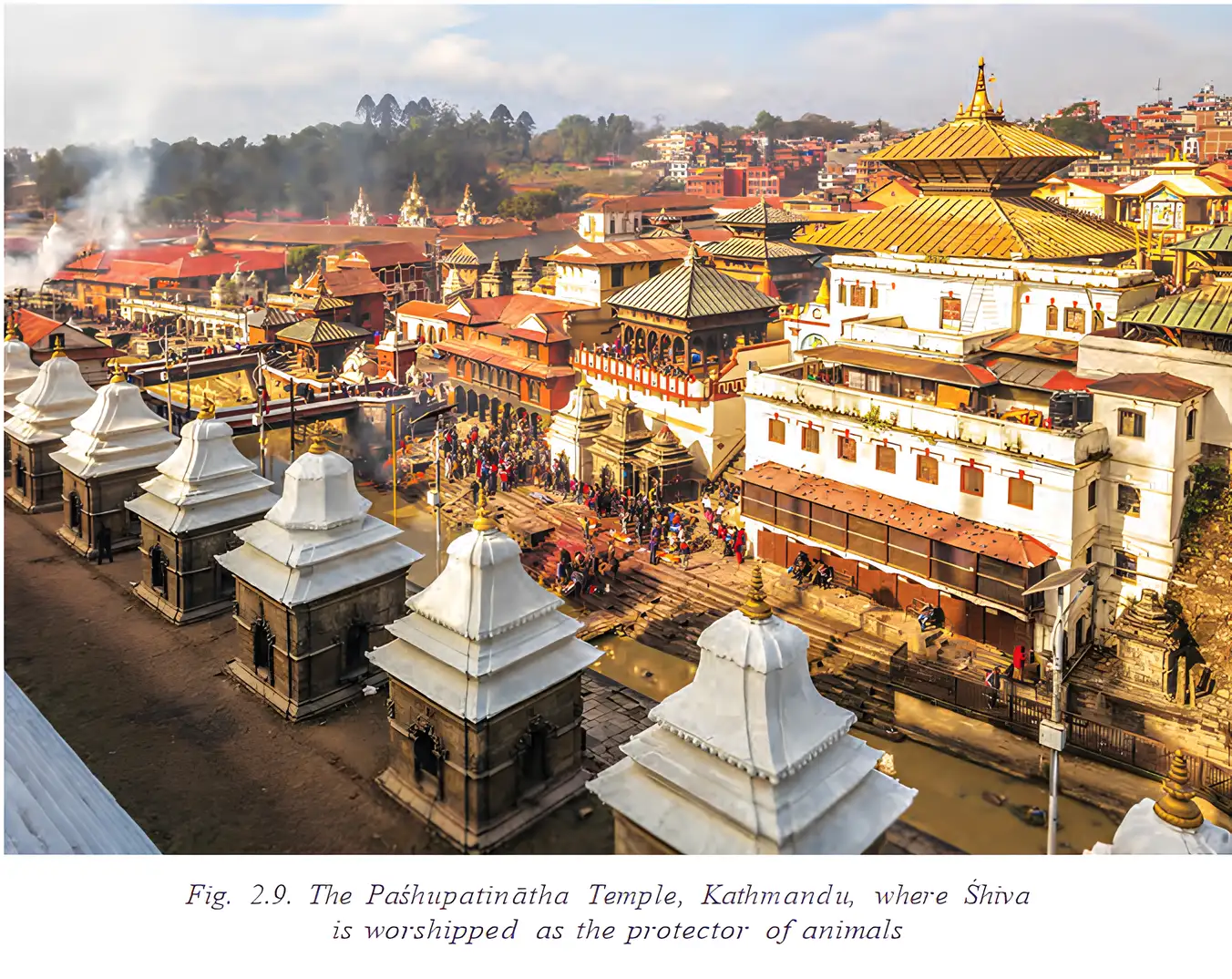
India–Nepal relations
- 1950The Treaty of Peace and Friendship shaped close diplomatic relations between India and Nepal.
Treaty, open border and movement
- 1950 Treaty: The Treaty of Peace and Friendship provides for open borders, free movement of people and goods, and cooperation in defence and foreign policy.
- Open border: Citizens can cross between India and Nepal without passports or visas.
- Everyday benefits: People cross for family ties, work, education, healthcare, trade and religious visits; border towns have busy markets and close connections.
- Safety: The two countries cooperate to keep the open border safe and prevent its misuse.
| Direction | Main goods |
|---|---|
| India supplies Nepal | Petroleum, medicines, food items and manufactured products |
| Nepal exports to India | Agricultural produce, handicrafts and garments |
Why India–Nepal cooperation matters
- Trade and integration: Exchanges support economic development and strengthen social and economic ties among border communities.
- Partnership: The relationship is shaped by shared history, faith and geography, and a commitment to regional harmony.
- Open border
- A border that allows people from two countries to cross without a passport or visa.
- Transboundary rivers
- Rivers or river systems shared by countries across their borders.
- Sundarbans
- A shared mangrove region and UNESCO World Heritage Site important for biodiversity and cyclone protection.
- Treaty of Peace and Friendship
- The 1950 agreement that supports India–Nepal cooperation and free movement across their border.
What is the significance of the open India–Nepal border?
Quick recap
- Bangladesh became independent in 1971; it shares Bangla, a long land border and river systems with India.
- Ganga- and Brahmaputra-origin river systems support farming, fishing, transport and livelihoods in India and Bangladesh.
- India and Bangladesh cooperate in managing the Sundarbans, a biodiversity-rich region that also helps protect against cyclones.
- Global warming and climate change are linked to rising sea levels and more intense cyclones that threaten homes and livelihoods in Bangladesh.
- Nepal shares an open border with five Indian states and strong cultural and religious connections with India.
- The 1950 India–Nepal treaty supports free movement and cooperation in defence and foreign policy.
- India is Nepal’s largest trading partner, while Nepal exports agricultural goods, handicrafts and garments to India.
India and Her Land-based Neighbours Part-3
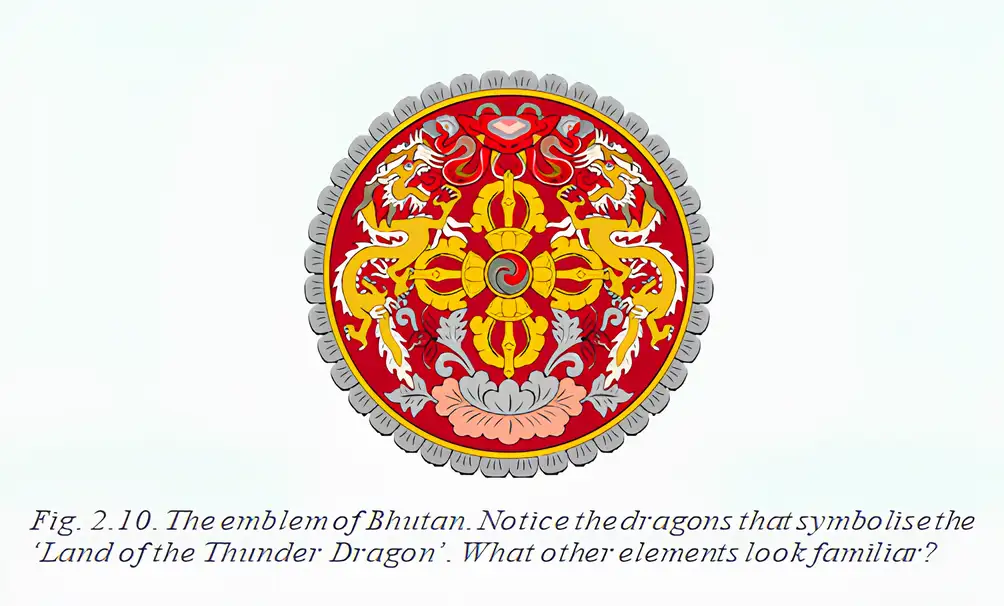
Bhutan: The Land of the Thunder Dragon
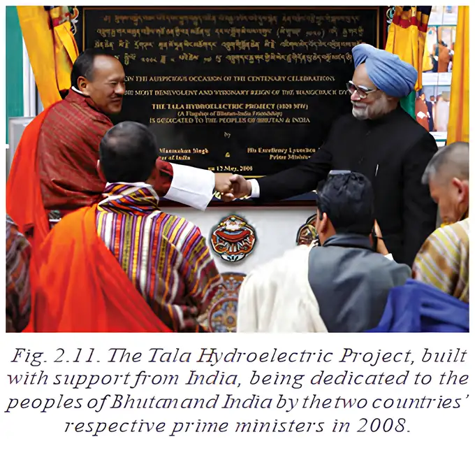
Rivers and Hydroelectric Cooperation
Buddhist and Cultural Connections
Three Main Schools of Buddhism
| School | Main features | Major regions of following |
|---|---|---|
| Theravada (“School of the Elders”) | Considered closest to the Buddha’s original teachings. | Mainly Sri Lanka and Southeast Asia, especially Thailand and Myanmar. |
| Mahayana (“Great Vehicle”) | Includes beliefs such as the Buddha’s divine nature and ability to guide people in many forms; sub-schools such as Zen developed. | China, Japan and Korea. |
| Vajrayana (“Diamond Vehicle” or Tantric Buddhism) | An extension of Mahayana; uses mantras, mandalas and visualisations of the Buddha and bodhisattvas. | Tibetan Buddhism derived from this school; it also spread to Bhutan. |
Development and Spread of Buddhist Schools
- Around the 3rd century BCETheravada took shape.
- Around the 1st century BCEMahayana emerged.
- Around the 6th century CEVajrayana arose as an extension of Mahayana.
- Around the 7th century CETibetan Buddhism derived from Vajrayana.
- 8th century CEGuru Padmasambhava introduced Vajrayana Buddhism to Bhutan.
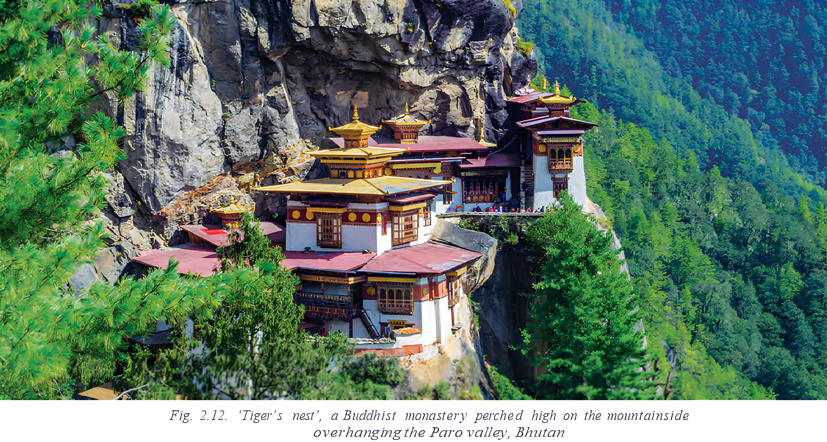
Gross National Happiness
How do rivers strengthen India–Bhutan cooperation?
What does Bhutan’s Gross National Happiness Index assess?
Quick recap
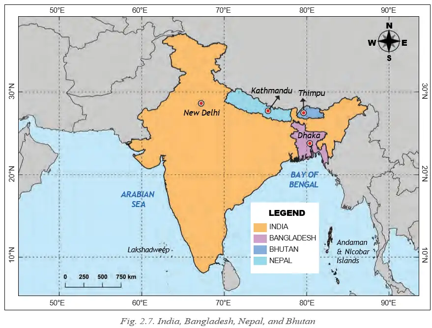
- Bhutan, or Drukyul, is a landlocked Himalayan kingdom between India and China.
- It borders Sikkim, West Bengal, Assam and Arunachal Pradesh.
- Rivers from Bhutan support agriculture and hydropower cooperation with India.
- Buddhist heritage, pilgrimage and Guru Padmasambhava strengthen India–Bhutan cultural ties.
- Theravada, Mahayana and Vajrayana developed at different times and spread across Asia.
- Bhutan’s Gross National Happiness Index measures progress holistically, including sustainability, governance and culture.
India and Her Land-based Neighbours Part-4
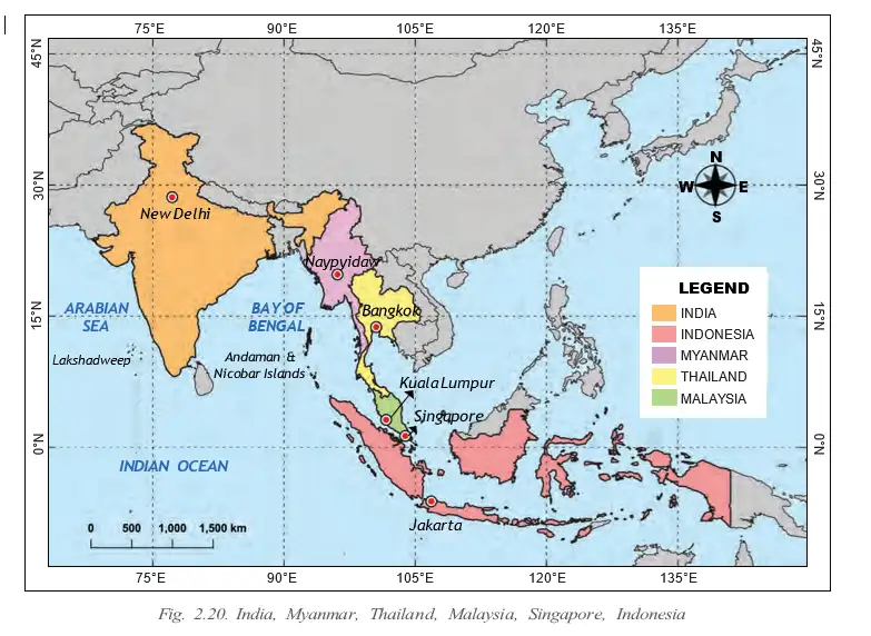
India’s Gateway to Southeast Asia: Myanmar
India–Myanmar connections
- Longstanding ties: India and Myanmar, formerly known as Burma, share historical, ethnic and cultural connections, despite periods of political turmoil.
- Buddhism: India, the birthplace of Buddhism, has special spiritual significance for many people in Myanmar, who visit India on pilgrimages.
- Shared boundaries: The countries share a land border and a maritime boundary in the Bay of Bengal.
- Northeastern states: Arunachal Pradesh, Nagaland, Manipur and Mizoram border Myanmar, supporting cross-border interaction and cultural exchange.
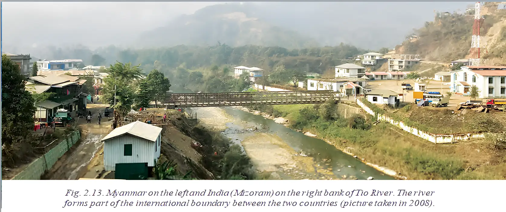
Land Border Crossing Agreement — The 2018 India–Myanmar agreement that eased cross-border movement for people living in border areas.
Border agreement and movement
- 2018 agreement → easier movement for people living in border areas
- Easier crossing → increased trade and connectivity
- More interaction → stronger people-to-people ties, especially between northeast India and Myanmar
- Conflicts in border areas → some restrictions on free movement in recent years
India–Myanmar border cooperation
- 2018India and Myanmar signed the Land Border Crossing Agreement to ease border-area movement and support trade and connectivity.
- Recent yearsConflicts in border areas have led to some restrictions on free movement.
Cultural cooperation
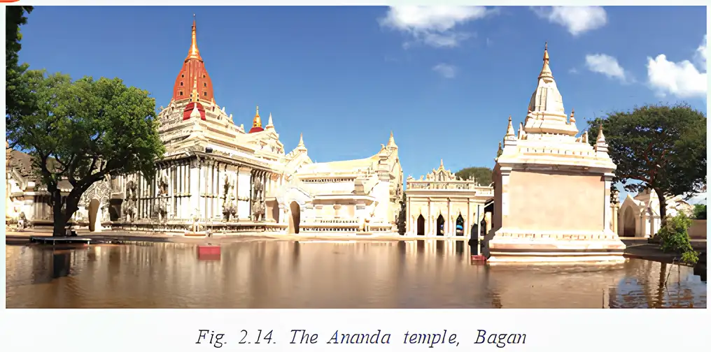
- Temple restoration: India helped restore the earthquake-damaged Ananda Temple at Bagan, among other sites.
- Buddha statue: India gifted a 16-foot replica of the Sarnath Buddha statue to the Shwedagon Pagoda in Yangon.
Afghanistan: A Land-locked Neighbour
Geography and access
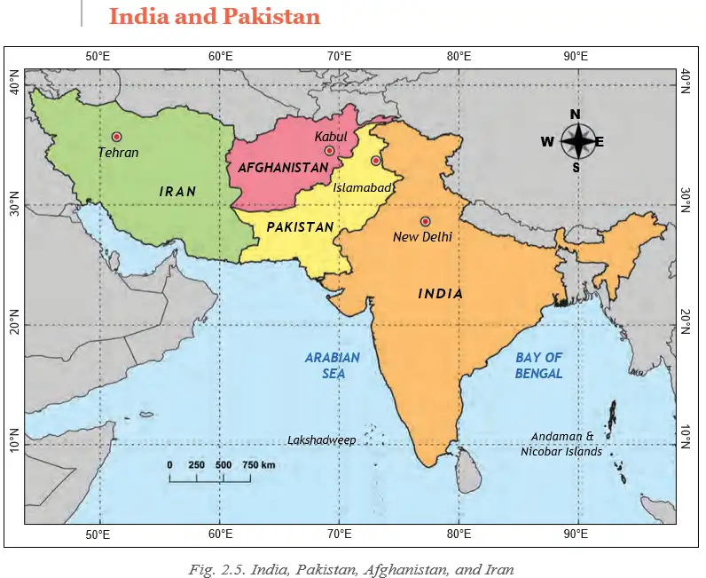
- Afghanistan: A multiethnic, landlocked country in south-central Asia.
- Earlier connection: Afghanistan once shared a direct land border with India.
- Access after 1947: The creation of Pakistan complicated direct access between India and Afghanistan.
- Relations: Despite geopolitical challenges, India and Afghanistan have generally maintained close, friendly ties based on shared history, culture and strategic interests.
How Pakistan’s creation affected access
- India and Afghanistan once shared a direct land border
- Pakistan was created in 1947
- Direct access between India and Afghanistan became complicated
Uttarapatha — An ancient trade route linking the Ganga plains to Central Asia through Afghanistan.
Uttarapatha and cultural exchange
- Ganga plains → Afghanistan → Central Asia
- The route connected Gandhara (identified in the text with modern Kandahar) with Takṣhaśhilā, Varanasi and Paṭaliputra.
- Travel and trade → exchange of goods, religions and ideas
- Cultural exchange → spread of Buddhism, Hinduism, art and philosophy across the region
Afghanistan’s historical links with India
- Before Islam spread in the 7th century CE: Afghanistan was a thriving centre of Buddhist and Hindu culture.
- Kingdoms: Kapiśha and Zabul reflected Indian systems of governance.
- Bamiyan Buddhas: The gigantic cliff-carved statues symbolised the reach of Mahayana Buddhism from India; they were destroyed in 2001.
Key dates in India–Afghanistan connections
- Before the 7th century CEAfghanistan was a thriving centre of Buddhist and Hindu culture before the spread of Islam.
- 1947The creation of Pakistan complicated access between India and Afghanistan.
- 2001The Buddhas of Bamiyan were destroyed.
Recent cooperation
- People-to-people ties: India and Afghanistan continue to share strong connections.
- Indian support: India has supported education, healthcare and infrastructure development in Afghanistan.
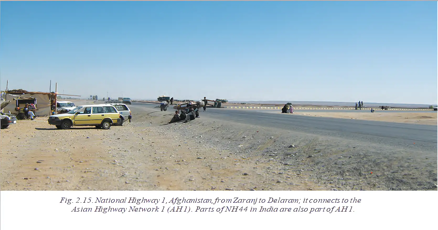
- Examples: Projects include the Afghan Parliament building and the Zaranj–Delaram highway.
- Significance: These efforts reflect a wish to build on their shared history of friendship and mutual respect.
- Land-locked
- Surrounded by land and without a coastline.
- Uttarapatha
- An ancient route connecting the Ganga plains with Central Asia via Afghanistan.
- Mahayana Buddhism
- A Buddhist tradition whose influence reached Afghanistan, represented by the Bamiyan Buddhas.
- Land Border Crossing Agreement
- The 2018 India–Myanmar agreement easing movement across their land border.
Why is Myanmar important for India’s connection with Southeast Asia?
How did the Uttarapatha strengthen links between India and Afghanistan?
Give two examples of India’s support for Afghanistan.
Quick recap
- India and Myanmar share historical, ethnic, cultural, land and maritime connections.
- Four Indian northeastern states border Myanmar; the 2018 agreement eased cross-border movement, trade and connectivity.
- Conflicts in Myanmar’s border areas have led to some restrictions on free movement.
- Afghanistan is landlocked, and Pakistan’s creation in 1947 complicated direct access from India.
- The Uttarapatha connected the Ganga plains to Central Asia via Afghanistan, enabling trade and cultural exchange.
- India has supported Afghanistan through education, healthcare and infrastructure projects.
India’s Maritime Neighbours Part-1
Early Maritime Links and SAARC
Early trade across the seas
- Trade: From a few centuries BCE, Indian traders sailed to Southeast Asia seeking gold and other valuable resources.
- Frequent destinations: Java, Sumatra and Malaya were associated with the names Suvarṇabhumi (“golden land”) and Suvarṇadvipa (“golden island”).
- Regional cooperation: Several Indian Ocean regional groups also work together for specific purposes.
SAARC — The South Asian Association for Regional Cooperation is a group formed in 1985 to promote mutual interests and sociocultural and economic progress.
SAARC: members and aims
- Members: Afghanistan, Bangladesh, Bhutan, India, the Maldives, Nepal, Pakistan and Sri Lanka.
- Aims: Cooperation and resource-sharing in development, science, education, health and other areas.
- Challenge: Political tensions among some members have often disrupted SAARC’s functioning.
Sri Lanka: India’s Nearest Maritime Neighbour
Location and shared heritage
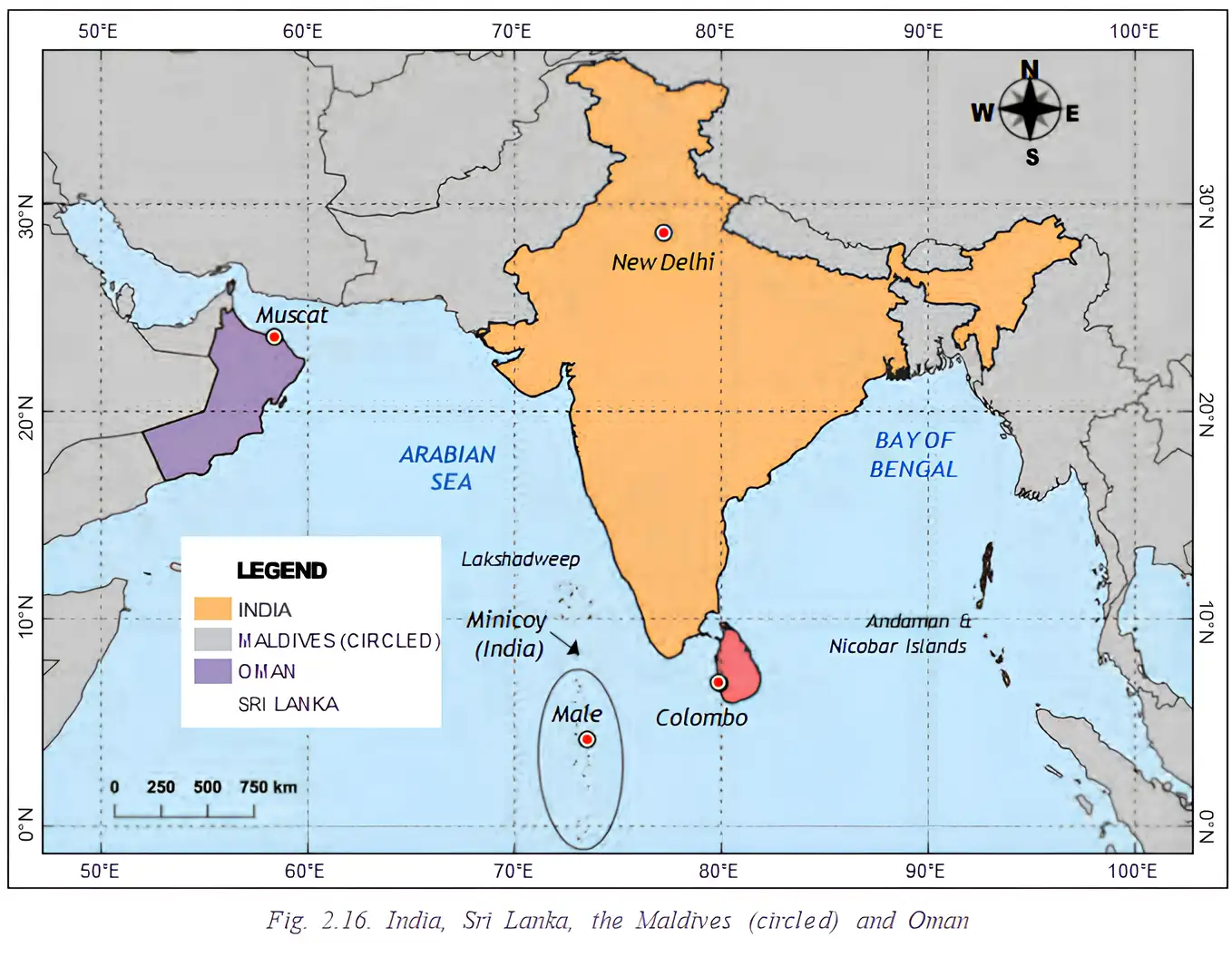
- Location: Sri Lanka is an island nation southeast of India, separated from it by the Palk Strait.
- Distance: The countries are about 32 km apart at their nearest point.
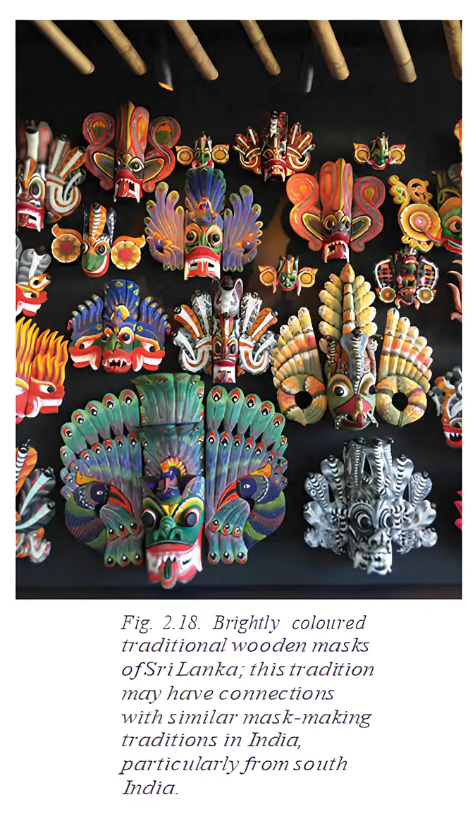
- Buddhism: Mahendra and Sanghamitra, son and daughter of Emperor Ashoka, introduced Buddhism to Sri Lanka in the 3rd century BCE.
- Hinduism: It also reached Sri Lanka, notably through the two Indian Epics; the countries continue to share spiritual and cultural traditions.
Sri Lanka’s civil war and displacement
- From the mid-1980s to around 2010, conflict took place mainly between the Sinhalese majority, whose language is Sinhala, and the Tamil minority, which has close cultural ties to India.
- The fighting forced many Tamil families to leave Sri Lanka.
- Many displaced families moved to south India, especially Tamil Nadu.
India–Sri Lanka relations
- Shared ties: The partnership draws on cultural closeness, historical links and economic cooperation.
- Cooperation: The two countries also collaborate strategically and through people-to-people exchanges and regional groupings.
- Shared goals: Their relationship supports peace and development in South Asia.
The Maldives: A Nation of Islets
Geography and cultural links
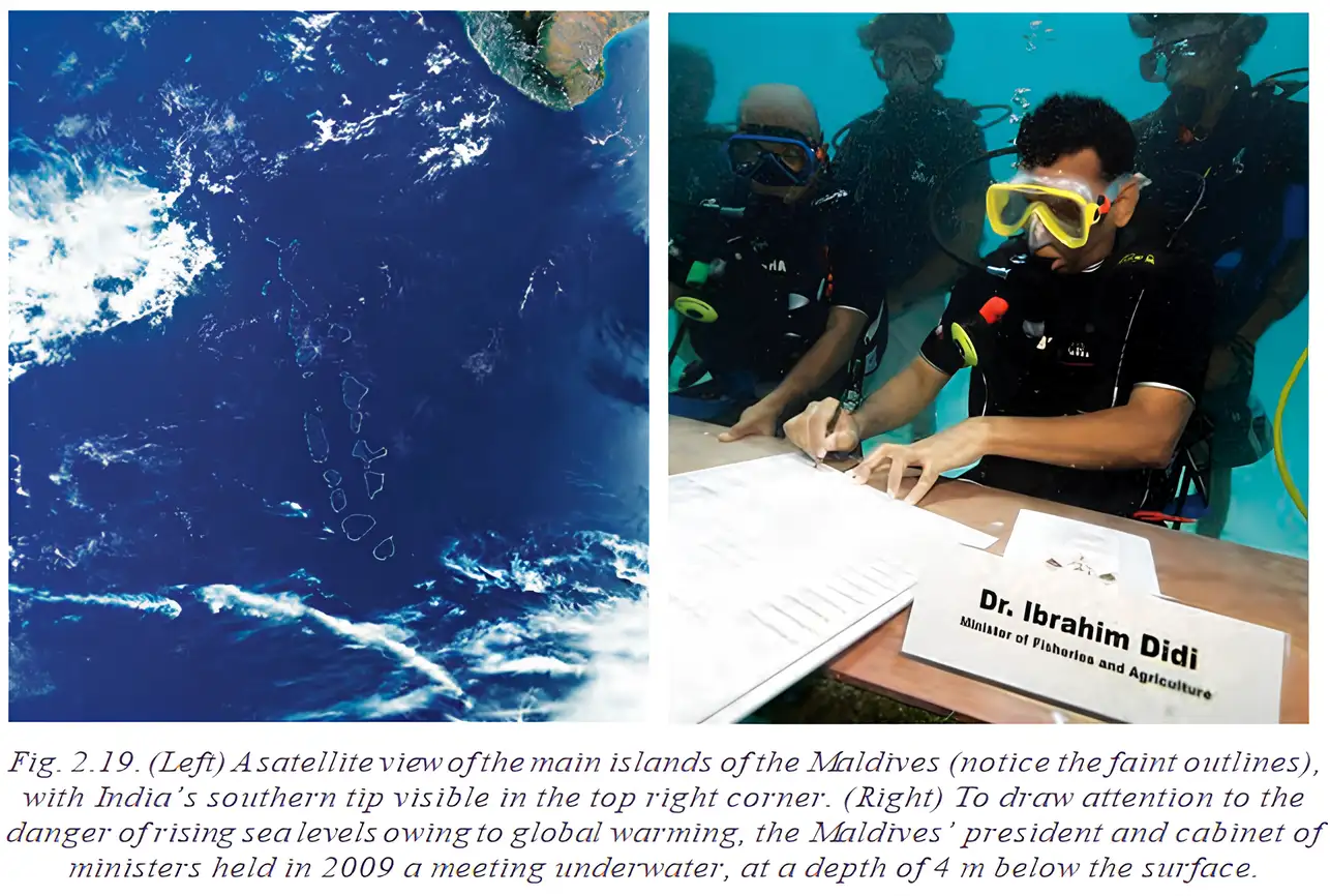
- Geography: The Maldives consists of over 1,100 islets and lies about 130 km from Minicoy, part of India’s Lakshadweep Union Territory.
- Importance: Its location makes it an important Indian neighbour for trade and security in the Indian Ocean.
- Early links: Maritime trade shaped centuries-old ties; archaeological remains of Buddhist temples and inscriptions show that Buddhism reached the Maldives early.
- South Indian influence: Tamil Nadu and Kerala influenced Maldivian language, food and arts. Coconut curries, roshi and Boduberu dance reflect links with South Indian flavours and rhythms.
Dhivehi — The official language of the Maldives, also called Maldivian, shaped by contact with Indian languages and cultures.
Dhivehi and Indian language influences
- Sources of words: Dhivehi includes words from Sanskrit, Prakrit, Tamil, Malayalam and Hindi.
- Examples: Raajje (“king”) and mas (“fish”) echo Sanskrit raja and matsya; dhoni (“boat”) and kukulhu (“chicken”) share roots with Tamil and Malayalam.
- Modern influence: Hindi words such as filmu have entered everyday use through Bollywood.
- Other links: South Indian influences are also evident in Maldivian boat-building techniques.
India–Maldives cooperation
- Recognition: India was among the first countries to recognise the Maldives after it became independent in 1965.
- Cooperation: The countries have developed strong ties in defence, trade and disaster relief.
- Crisis support: India provided rapid assistance during the 2004 tsunami, the 2014 water crisis in Malé and the COVID-19 pandemic.
- Regional role: Such responses strengthened India’s position as a trusted first responder in the region.
Climate change and the Maldives
- Climate change raises sea levels.
- Sea levels could rise by up to 1 metre by the end of the century.
- Many Maldivian islands could be partly submerged.
- The Maldives and India support sustainability through cooperation, including the International Solar Alliance.
International Solar Alliance
- Purpose: The Maldives is a member of this Indian initiative, which shares solar-energy research and technology.
- Significance: Participation reflects long-term cooperation on sustainability.
- Palk Strait
- The narrow stretch of sea separating India and Sri Lanka.
- Islet
- A very small island; the Maldives consists of over 1,100 islets.
- Suvarṇabhumi / Suvarṇadvipa
- Names meaning “golden land” and “golden island,” associated with Java, Sumatra and Malaya.
- First responder
- A country that can provide prompt help to neighbours during a crisis.
Key Dates and Periods
- A few centuries BCEIndian traders sailed to Southeast Asia in search of gold and other valuable resources.
- 3rd century BCEMahendra and Sanghamitra introduced Buddhism to Sri Lanka.
- 1965The Maldives became independent; India was among the first countries to recognise it.
- 1985SAARC was formed.
- Mid-1980s to around 2010Sri Lanka’s civil war led many Tamil families to move to south India.
- 2004India helped the Maldives during the tsunami.
- 2014India helped the Maldives during the water crisis in Malé.
- By the end of the centurySea level around the Maldives could rise by up to 1 metre, partly submerging many islands.
Why is Sri Lanka considered India’s nearest maritime neighbour?
Give two examples of India’s assistance to the Maldives.
Quick recap
- Indian traders sailed to Southeast Asia for valuable resources; Java, Sumatra and Malaya were linked with the names Suvarṇabhumi and Suvarṇadvipa.
- SAARC, formed in 1985, promotes regional cooperation among eight South Asian members, though political tensions can disrupt its work.
- Sri Lanka is about 32 km from India at its nearest point; the countries share Buddhist, Hindu and wider cultural ties.
- Sri Lanka’s civil war was mainly between the Sinhala-speaking Sinhalese majority and the Tamil minority, which has close cultural ties to India; many Tamil families moved to Tamil Nadu.
- The Maldives has over 1,100 islets and deep cultural, linguistic and maritime links with southern India.
- India–Maldives cooperation includes defence, trade, crisis assistance and solar-energy collaboration.
- Rising sea levels threaten the low-lying Maldivian islands.
India’s Maritime Neighbours Part-2
India–Thailand Connections
Maritime links and early exchange
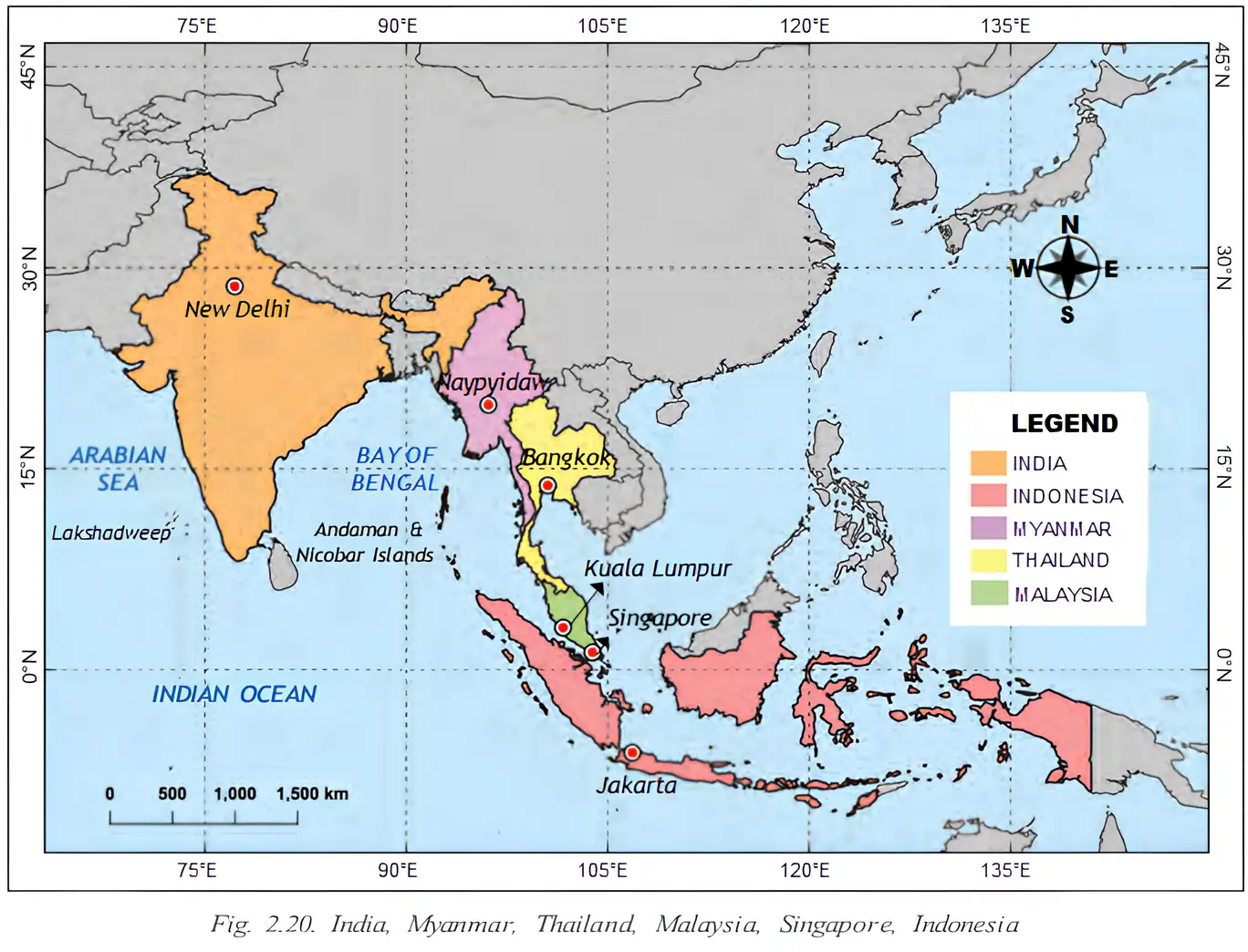
- Geography: India and Thailand share a maritime boundary and have been connected by sea routes since ancient times.
- Early contact: By the 3rd century BCE, Indian traders and scholars sailed to the region now called Thailand.
- Exchange: Traders carried goods such as spices and textiles; travellers also brought religious and cultural ideas.
| Thai name | Date or period | Indian connection |
|---|---|---|
| Dvaravati culture | 6th–11th centuries CE | Its name comes from a Sanskrit word meaning “that which has gates” and refers to Dvaraka, Krishna’s city in the Mahabharata. |
| Ayutthaya Kingdom | Founded in 1351 | Named after Ayodhya, the birthplace of Rama in the Ramayana. |
Key dates and periods
- 3rd century BCEIndian traders and scholars were travelling to the region now called Thailand.
- 6th–11th centuries CEThe Dvaravati culture flourished in Thailand.
- 1351The Ayutthaya Kingdom was founded.
Religious and cultural links
- Shared heritage: Buddhism and Hinduism strengthened cultural ties between India and Thailand.
- Buddhist influence: Indian monks, scholars and texts helped shape Thai religious and philosophical traditions; Theravāda Buddhism is widely practised in Thailand.
- Hindu influence: Hindu deities and stories from Indian epics appear in Thai royal ceremonies, dance forms and literature.
- Royal names: Monarchs of Thailand’s Chakri dynasty have been named after Rama; the current king is Rama X.
Shared Stories and Modern Connectivity
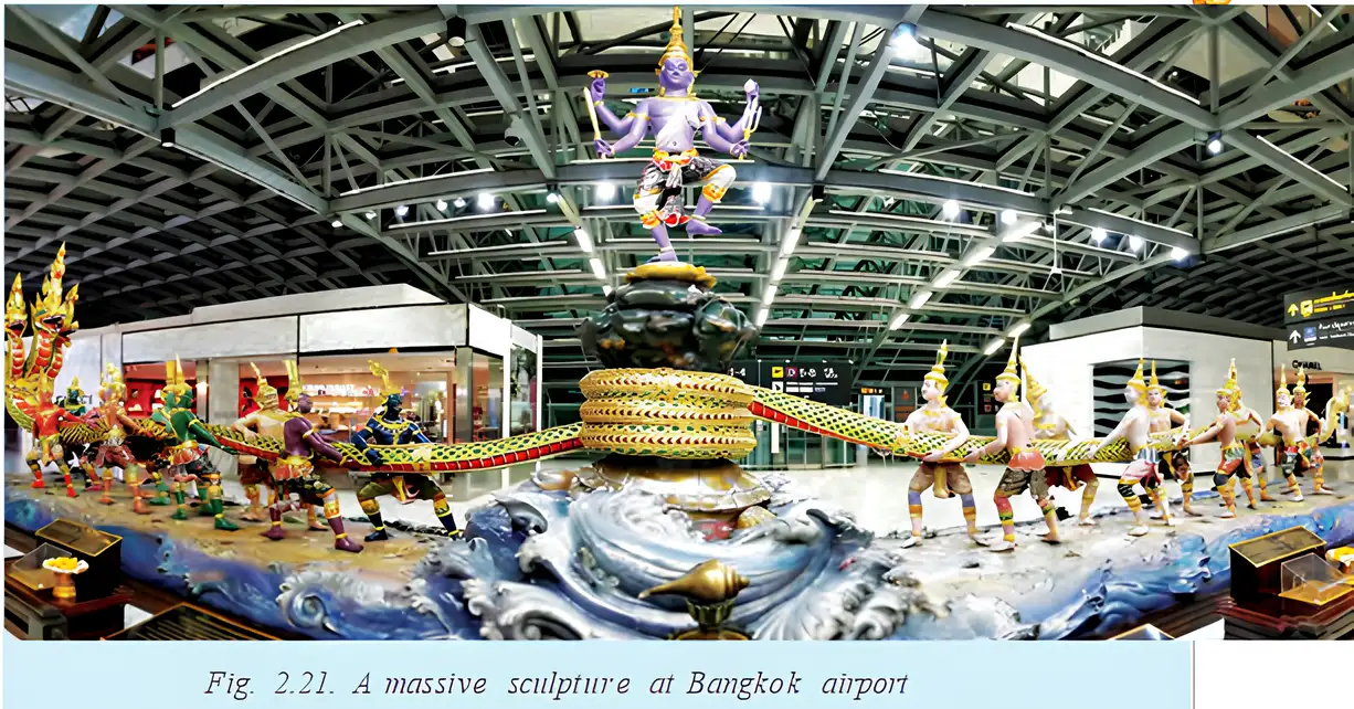
The Samudra Manthan story
- Devas and asuras join forces to churn the cosmic ocean in search of amrita, the nectar of immortality.
- Vasuki, the serpent, serves as the churning rope; Vishnu presides over the operation.
- Outcome: Vishnu deceives the asuras so that the amrita goes to the devas alone.
The India–Myanmar–Thailand Trilateral Highway
- Route: The highway runs from Manipur in India, through Myanmar, and into Thailand.
- Purpose: It improves overland connectivity, supports regional trade and encourages cooperation among the countries.
- Significance: It is a modern effort to renew connections that have linked the region for centuries.
- Dvaravati
- A Thai culture that flourished from the 6th to the 11th centuries CE; its name has a Sanskrit connection to Dvaraka.
- Ayutthaya
- A Thai kingdom founded in 1351 and named after the Indian city of Ayodhya.
- Amrita
- The nectar of immortality sought in the Samudra Manthan story.
- Trilateral Highway
- A road link connecting India, Myanmar and Thailand.
How do the names Dvaravati and Ayutthaya reflect Indian influence?
State the route and importance of the India–Myanmar–Thailand Trilateral Highway.
Quick recap
- India and Thailand have long been connected by maritime routes, trade and cultural exchange.
- Dvaravati and Ayutthaya show Indian influence in Thai place names and history.
- Indian ideas helped shape Thai Buddhism, Hindu traditions, arts and royal ceremonies.
- The Samudra Manthan story is represented in a sculpture at Bangkok’s Suvarnabhumi Airport.
- The Trilateral Highway links India, Myanmar and Thailand and supports trade and cooperation.
India’s Maritime Neighbours Part-3
The Malay Peninsula
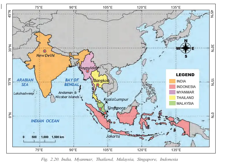
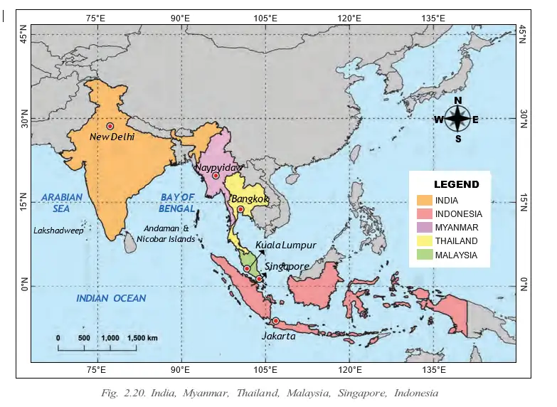
India–Malaysia links — India and Malaysia have historical, cultural and economic connections, linked by sea routes across the Bay of Bengal for over two millennia.
Cultural links and migration
- Early influence: Hindu and Buddhist cultural influences reached the region; the Srivijaya Kingdom is one example associated with this heritage.
- Writing: Around the 4th century CE, the region adopted a script based on India’s Brahmi script.
- Religion: Islam became the predominant religion by the 15th century, while Indian influences remain visible in Malaysian art and literature.
- Migration: In the 19th and 20th centuries, many workers, mainly from south India, migrated to Malaysia to work on rubber plantations.
- Indian-origin community: About 9% of Malaysia’s population is of Indian origin; the community remains prominent today.
Present-day India–Malaysia ties
- Trade: India is one of Malaysia’s largest trading partners; cooperation includes palm oil, energy, infrastructure and information technology.
- Strategic partnership: The countries work together on regional security and maritime stability.
- Business links: Indian organisations collaborate with Malaysian companies in manufacturing, information technology, research, tourism and education.
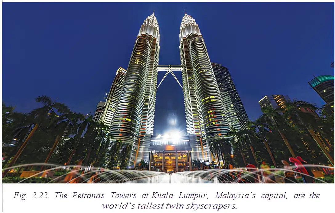
Key periods in India–Malaysia connections
- Over two millennia agoSea routes across the Bay of Bengal connected India and the Malay Peninsula.
- Around the 4th century CEA script based on India’s Brahmi script was adopted in the region.
- By the 15th centuryIslam had become the predominant religion in the region.
- 19th and 20th centuriesMany workers, mainly from south India, migrated to Malaysia for work on rubber plantations.
The ‘Lion City’
Singapore — Singapore’s name comes from ‘Singapuram’, meaning ‘lion city’, the name of an ancient kingdom near the southern tip of present-day Malaysia.
Early links and political history
- Early contacts: Singapore had close cultural and commercial ties with India; Buddhist monks and traders visited the region a few centuries BCE.
- Political changes: Singapore became a British colony, later became part of Malaysia, and then became a separate nation in 1965.
Singapore’s political history
- A few centuries BCEBuddhist monks and traders visited the region, reflecting early links with India.
- Before 1965Singapore was a British colony and later became part of Malaysia.
- 1965Singapore became a separate nation.
Languages and urban life
- Languages: Tamil is one of Singapore’s official languages, reflecting longstanding ties with south India.
- Urban planning: Singapore is regarded as a benchmark for urban planning and city maintenance.
- Public responsibility: Residents help keep streets litter-free; heavy fines apply for littering, traffic-rule violations and jaywalking.
- Sustainable features: Parks, walkways and terrace gardens support wellbeing and make the city people-friendly.
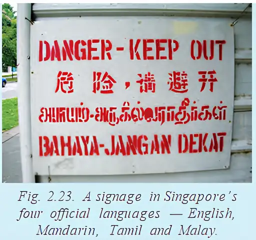
Jaywalking — Walking or crossing roads without taking care to follow traffic rules.
India–Singapore connections today
- Investment: Singapore is one of the largest foreign investors in India, especially in infrastructure and technology; Indian companies also have offices in Singapore.
- Travel and education: Singapore receives many Indian tourists and is a preferred destination for Indian students pursuing higher studies.
- Culture and religion: Indian influence is visible in art, cuisine and religion; Buddhism is currently the most widely practised religion in Singapore.
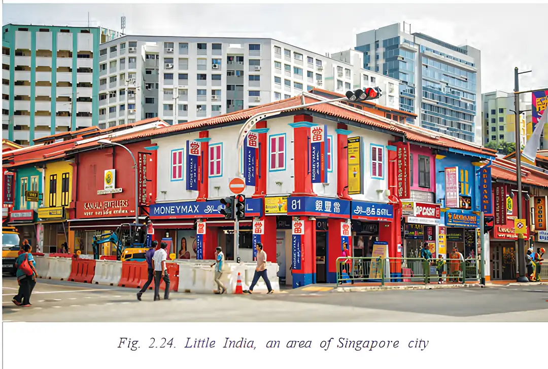
- Indian-origin residents: About 9% of Singapore’s residents are of Indian origin; many live in the area called Little India.
- Malay Peninsula
- A Southeast Asian peninsula linked to India by sea routes across the Bay of Bengal.
- Brahmi script
- An ancient Indian script that formed the basis of a script adopted in the region around the 4th century CE.
- Singapuram
- The name from which Singapore derives; it means ‘lion city’.
- Little India
- A Singapore neighbourhood where Indian culture and heritage are prominent.
How did Indian migration contribute to Malaysia’s links with India?
State two features of present-day India–Singapore relations.
Quick recap
- Sea routes across the Bay of Bengal connected India and the Malay Peninsula for over two millennia.
- Hindu and Buddhist influences, including the Srivijaya example and Brahmi-based writing, shaped the region.
- Many workers from India migrated to Malaysia in the 19th and 20th centuries; about 9% of Malaysia’s population is of Indian origin.
- India and Malaysia cooperate in trade, business, regional security and maritime stability.
- Singapore’s name means ‘lion city’; it became a separate nation in 1965, and Tamil is one of its official languages.
- India and Singapore maintain strong investment, tourism, education and cultural links; about 9% of Singapore’s residents are of Indian origin.
India’s Maritime Neighbours Part-4
The Indonesian Archipelago
Archipelago — A large group or chain of islands.
Geography and early connections
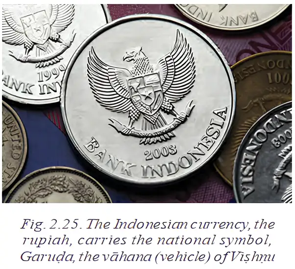
- Geography: Indonesia is an archipelago of several large islands and over 17,000 smaller ones. India and Indonesia are separated by the Bay of Bengal and the Andaman Sea.
- Early trade: Indian kingdoms traded by sea with Java and Sumatra over 2,000 years ago.
- Cultural links: Cooperation between Nālandā and the Muara Jambi temple complex strengthened ties; Islam later reached Indonesia from India.
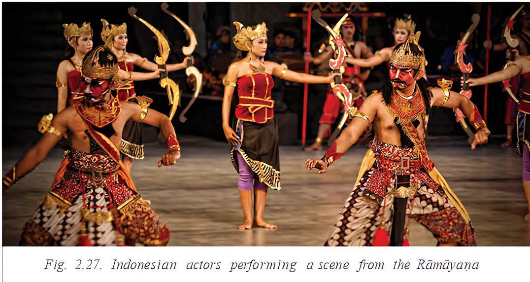
- Shared culture: Indonesian performances of the Ramayana reflect cultural connections with India.
Borobudur and Shared Culture
- Stupa
- A Buddhist shrine, often dome-shaped, that holds sacred relics.
- Mandala
- A geometric symbol used in Hindu, Buddhist and Jaina rituals, often representing the cosmos.
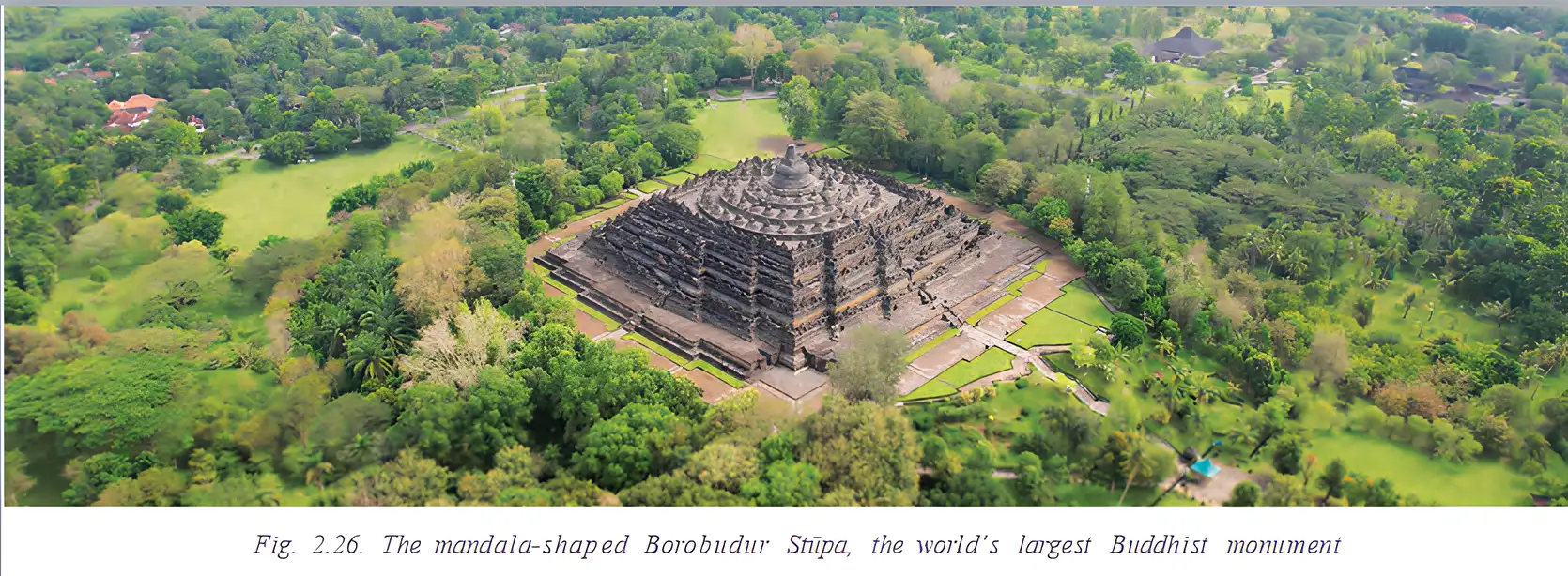
Borobudur Stupa
- Structure: Built of stone in the 8th and 9th centuries CE, Borobudur has a distinctive pyramidal form arranged in five large platforms.
- Sculptures: The monument contains over 500 Buddha statues and many smaller stupas.
- Design: Its geometric layout follows a mandala pattern.
India–Indonesia Cooperation
Partnership today
- Regional work: India and Indonesia cooperate in regional groups to support peace, trade and sustainable development in the Indo-Pacific.
- Strategic ties: Cooperation includes maritime security, defence and disaster relief.
- Shared concerns: Their long coastlines make piracy, climate change and the safety of sea lanes important common issues.
Earthquakes, Tsunami and Early Warning
Regional hazards
- Risk: Indonesia experiences frequent earthquakes and volcanic eruptions, making it one of the world’s most earthquake-prone countries.
- Tsunami: The earthquake beneath the Indian Ocean near Indonesia on 26 December 2004 triggered a massive tsunami.
- Loss of life: About 15,000 people died in India, especially in Tamil Nadu, Kerala and the Andaman and Nicobar Islands; more than 200,000 died across the region.
Tsunami Warning and Regional Cooperation
- The 2004 tsunami revealed the need for better early warnings.
- India, Indonesia, Sri Lanka, Thailand and other Indian Ocean countries joined efforts to build a warning network.
- Sensors, satellites and communication links detect threats and transmit alerts.
- The Indian Tsunami Early Warning Centre in Hyderabad helps warn India and neighbouring countries, potentially saving lives.
Key Dates and Periods
- Over 2,000 years agoSea trade connected Indian kingdoms with Java and Sumatra.
- 8th–9th centuries CEBorobudur was built in stone.
- 26 December 2004An Indian Ocean earthquake near Indonesia triggered a devastating tsunami.
Why is India–Indonesia cooperation important in the Indian Ocean region?
Quick recap
- Indonesia is an archipelago of several large islands and over 17,000 smaller ones.
- Trade and cultural exchange between India and Indonesia go back over 2,000 years.
- Borobudur is a stone Buddhist monument with five platforms and a mandala-based design.
- The two countries cooperate on Indo-Pacific peace, trade, defence and maritime security.
- The 26 December 2004 earthquake triggered a tsunami that caused extensive loss of life.
- A regional warning network and Hyderabad’s Indian Tsunami Early Warning Centre help alert countries to tsunami threats.
An Ancient Neighbour
India and Iran: Ancient Connections
Routes and Exchanges
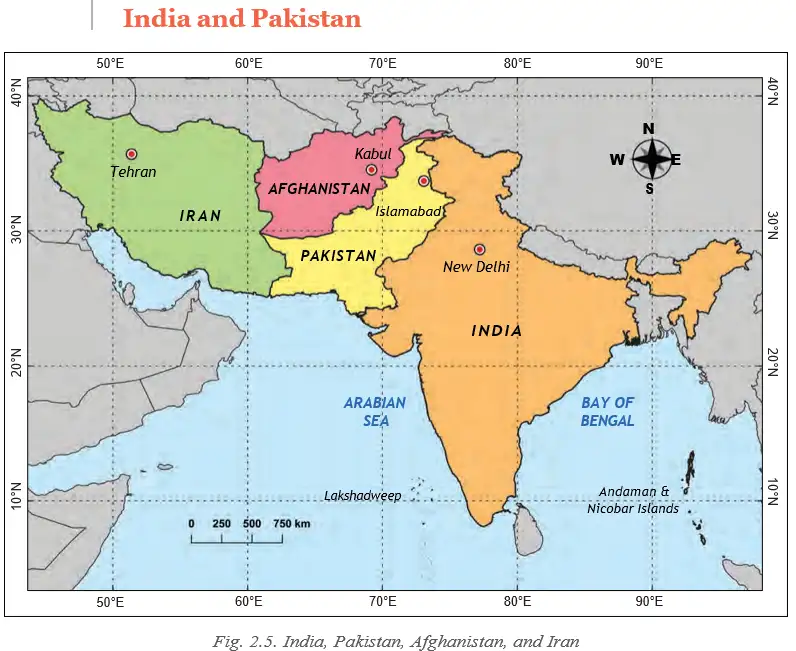
- Early ties: India and Iran had close trade and cultural connections from the Bronze Age.
- Land routes: Routes through present-day Pakistan and Afghanistan later became part of the Silk Route.
- Sea routes: Iran’s ports were within easy reach of India’s west coast.
- Exchanges: People, goods and ideas linked the two lands in language, literature, art, architecture and food.
- Silk Route
- A network of routes along which people, goods and ideas travelled between regions.
- Avesta
- The ancient sacred text of Zoroastrianism, with parallels to India’s Ṛigveda.
- Parasika
- The name used for Persians in Indian texts such as the Mahabharata.
- Parsis
- A community in India that remains a living link with ancient Persian culture.
Cultural and Language Links
- Sacred texts: The Avesta of Zoroastrianism has parallels with the Ṛigveda.
- Historical reference: The Mahabharata refers to Persians as Parasika.
- Language: Persian belongs to the same language family as Sanskrit; it was used as a court language in India by the Mughals and other rulers.
- Living connection: Parsis in India maintain a link with ancient Persian culture.
Modern India–Iran Cooperation
- Areas of cooperation: India and Iran work together in trade, energy and transport despite international challenges.
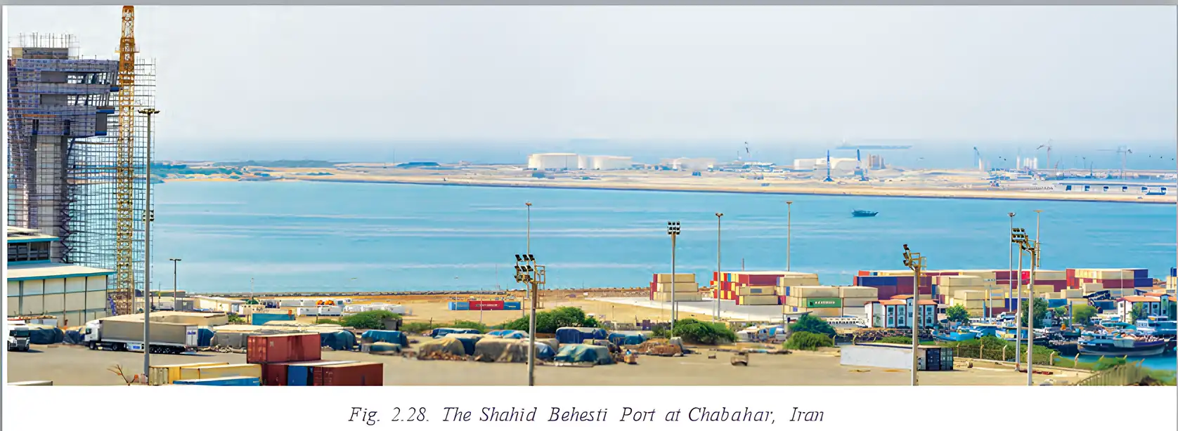
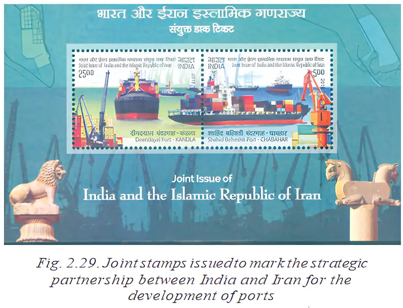
- Chabahar Port: India is helping develop this Iranian port, which improves India’s access to Afghanistan and Central Asia.
- Regional ties: Both countries continue to engage as important neighbours in Asia.
Why Chabahar Port Matters to India
- India helps develop Chabahar Port in Iran
- The port strengthens transport links
- India gains better access to Afghanistan and Central Asia
Oman: The ‘Land of Copper’
Location and Importance
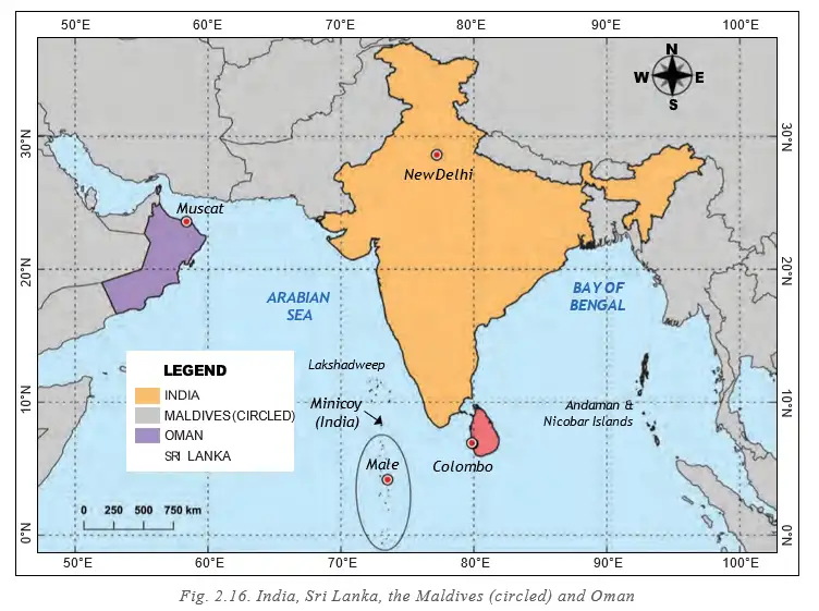
- Location: Oman lies on the southeastern coast of the Arabian Peninsula, at the meeting point of the Persian Gulf and Arabian Sea.
- Maritime links: Oman shares maritime boundaries with India.
- Strategic role: Oman is an important partner in India’s engagement with the Gulf region and plays a role in regional forums.
Ancient India–Oman Links
- Long contact: People-to-people links date back over 5,000 years, to the Indus or Harappan (Indus-Sarasvatī) civilisation.
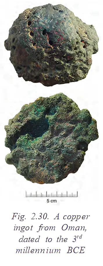
- Copper trade: Oman is rich in copper; Harappan traders are thought to have brought copper ingots from Oman.
- Destination: The ingots were likely taken to coppersmiths in Indus-Sarasvatī cities.
Ingot — A lump or block of metal shaped for convenient transport and reworking.
Indian Community in Oman
- Population: Over 10% of Oman’s population is of Indian origin.
- Settlement: Merchant communities from north-western India settled in Oman over the past few centuries; an indigenous Indian population also lives there.
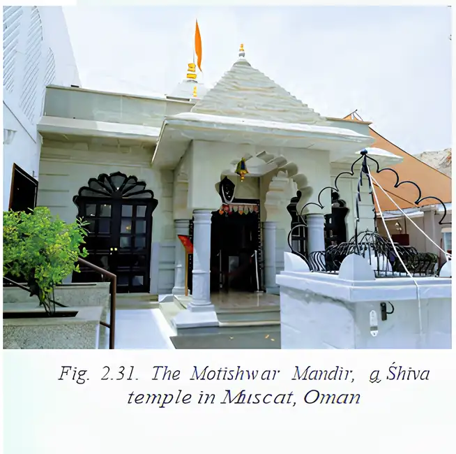
- Religious life: Oman’s Hindu community was allowed to build a Shiva temple in the early 20th century.
Defence and Maritime Cooperation
- Defence partnership: Oman is India’s closest defence partner in the Gulf.
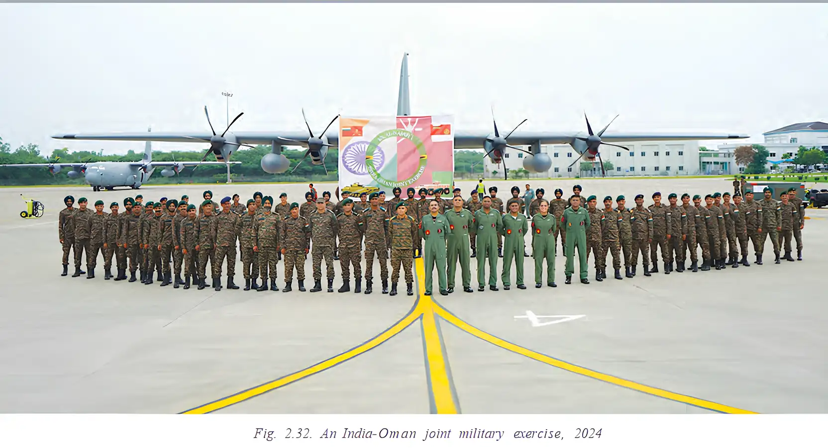
- Joint exercises: Oman was the first country in the region where India held joint military exercises with all three armed forces.
- Maritime security: India and Oman work together on Indian Ocean maritime security.
Key Dates and Periods
- Bronze AgeIndia and Iran had close trade and cultural ties.
- Over 5,000 years agoIndia–Oman people-to-people contact dates to the Indus or Harappan civilisation.
- 3rd millennium BCEAn ancient copper ingot from Oman dates to this period.
- Early 20th centuryOman’s Hindu community was allowed to build a Shiva temple.
- 2024Indian and Omani personnel took part in a joint military exercise.
How were India and Iran connected through trade and culture?
Why is Oman important to India?
Quick recap
- India and Iran have shared trade and cultural ties since the Bronze Age, using land and sea routes.
- The Silk Route and cultural links such as the Avesta–Ṛigveda parallels connected India and Iran.
- India’s work on Chabahar Port improves access to Afghanistan and Central Asia.
- India–Oman contact dates back over 5,000 years; Harappan traders are thought to have brought copper ingots from Oman to Indus-Sarasvatī cities.
- Over 10% of Oman’s population is of Indian origin, and the Hindu community has a Shiva temple in Muscat.
- Oman is India’s closest defence partner in the Gulf, and the two countries cooperate on Indian Ocean maritime security.
Before we move on
Historical Cultural Connections
India’s Links with Neighbouring Regions
- Cultural exchange: India and its neighbours have shared cultural, spiritual, religious and commercial exchanges for centuries.
- Cultural influence: Indian schools of thought and belief, arts, literature and architecture left a visible imprint across Southeast Asia.
- Trade routes: The Uttarapatha, Dakṣhiṇapatha, Silk Route and spice routes connected India with Central Asia, Southeast Asia and the Arabian Peninsula.
- Peaceful spread: Trade, pilgrimage and culture helped Indian traditions spread peacefully.
Historical Links in the Present
Continuing Connections
- Connectivity projects: Regional projects today aim to revive historical links between India and neighbouring regions.
- Popular culture: Indian films, music and television help sustain bonds across countries.
- Shared interests: Strategic and trade interests also strengthen present-day regional relationships.
- Uttarapatha
- An ancient trade route connecting India with regions to its north and northwest.
- Dakṣhiṇapatha
- An ancient trade route linking regions within India and areas to its south.
- Silk Route
- An ancient network of routes that connected India and other regions through trade and cultural exchange.
- Spice routes
- Trade routes through which spices and other goods were exchanged between regions.
How did ancient routes strengthen India’s connections with other regions?
Quick recap
- India and its neighbours have shared cultural, spiritual, religious and commercial exchanges for centuries.
- Indian thought, arts, literature and architecture influenced Southeast Asia.
- Ancient routes connected India to Central Asia, Southeast Asia and the Arabian Peninsula.
- Trade, pilgrimage and culture spread Indian traditions peacefully.
- Modern connectivity projects, popular culture and shared strategic and trade interests sustain regional bonds.
Social Science — ALL CHAPTERS
1
Geographical Diversity of India
2
Understanding the Weather
3
Climates of India
4
New Beginnings Cities and States
5
The Rise of Empires
6
The Age of Reorganisation
7
The Gupta Era: An Age of Tireless Creativity
8
How the Land Becomes Sacred
9
From the Rulers to the Ruled: Types of Governments
10
The Constitution of India - An Introduction
11
From Barter to Money
12
Understanding Markets
1
The Story of Indian Farming
2
India and Her Neighbours
3
Empires and Kingdoms: 6th to 10th Centuries
4
Turning Tides: 11th and 12th Centuries
5
India, a Home to Many
6
The State, the Government, and You
7
Infrastructure: Engine of India’s Development
8
Banks and the Magic of Finance